|
|
Expeditions to the Interior of California Central Valley, 1820-1840
Ch. 1: The Purisma Rebellion (Chumash Revolt of 1824)
Ch. 2: Trading Through the Southern Valley
Ch. 3: Sanchez, Vallejo, Estanislao
Ch. 4: Minor Expeditions, 1825 to 1840
Ch. 5: Personal Documents
By Sherburne F. Cook
University of California Anthropological Records, Volume 20, No. 5, pp. 151-214 | February 1, 1962
|
Chumash Revolt of 1824: Santa Clarita Valley Connections.
The Chumash Revolt of February 1824 occurred at the Missions Santa Ynez (modern Solvang), Purisma (Lompoc), Santa Barbara and to a lesser degree San Buenaventura (Ventura), but its ties to the history of the Santa Clarita Valley are significant. The uprising began when a Chumash boy was severely beaten when he tried to visit a relative who was imprisoned at Santa Ynez. The beating was carried out by a Mexican soldier named Valentin Cota. Valentin Cota was the son of a soldier named Manuel Cota, who with Francisco Lopez and Domingo Bermudez first discovered gold in Placerita Canyon 18 years later (1842). Lopez was related by marriage to Mexican Lt. Antonio del Valle (who figured in the 1824 revolt; see below) and was living with and probably working for the Del Valles in 1842. (Antonio died in 1841.) The first group of Mexican soldiers sent to pursue fleeing Indians from Mission Santa Barbara, in April 1824, was under the command of Narciso Fabregat, a lieutenant from Mazatlan who, according to manuscripts compiled by Cook[1], was stationed at the Rancho San Francsico (the western Santa Clarita Valley from Camulos to modern-day Canyon Country), which at the time was ranch land of the Mission San Fernando. Presumably Fabregat would have been quartered at the estancia de San Francsico Xavier at Castaic Junction. As indicated in the contemporary report (May 1824) by witness Fr. Antonio Ripoll[2] of Mission Santa Barbara, numerous unarmed, noncombatant Indians were murdered by Mexican soldiers, including individuals who came from the Mission San Fernando as reinforcements. At least one was put to death by Fabregat's troops when they lacked sufficient manpower to detain him. Some Indians, according to interviews cited by Cook, "were caught and bound by cowboys at Rancho San Francisco" before being returned to the Mission San Fernando. The revolt ended in June 1824 when a second set of troops, this time under command of Capt. Pablo de la Portilla and his lieutenants — Antonio del Valle of the San Blas Infantry, Juan Maria Ibarra of the Mazatlan Company and Santa Barbara Second Lieutenant Domingo Carrillo — pursued escaping Indians. Their route took them from the Presidio at Santa Barbara to Mission San Buenaventura and on through the Santa Clara River Valley, stopping at Camulos (per Cook's documents, "a sheep ranch belonging to the Mission San Fernando"[3]), and continuing past "San Xavier" (Castaic Junction area)[4], then north through Grapevine Canyon (aka Tejon Pass or "the Grapevine") into the "Tulares" (southern San Joaquin Valley). There they encountered the Indians at "Lake Misjamin," which Cook believes to be Kern Lake. The Indians were pardoned and convinced to return to the missions. The year 1824 is thought to be the time Antonio del Valle came into possession of the Rancho San Francisco (although he was not formally granted it until 1839). We have yet to determine whether Del Valle's actions in quashing the Chumash Revolt and his possession of the land are directly connected. — Leon Worden 2014 1. "Expeditions to the Interior of California Central Valley, 1820-1840" by Sherburne F. Cook, University of California Anthropological Records 20:5 (1962). 2. "Fray Antonio Ripoll's Description of the Chumash Revolt at Santa Barbara in 1824" (dated May 5, 1824), Translated and Edited by Maynard Geiger, O.F.M., Historical Society of Southern California Quarterly, December 1970:345-364. 3. Lopez (1974) says Camulos, meaning "the cedar," was a "cattle station." 4. Cook (1962) puts it this way in his footnotes: "The route went from Ventura up the Santa Clara River to above the junction of Piru Creek, then northeast across the hills to the present course of Highway U.S. 99 which was then followed north to Grapevine where the lake can first be seen."
|
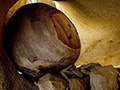
Storage Basket
Chumash Revolt of 1824
|
The site owner makes no assertions as to ownership of any original copyrights to digitized images. However, these images are intended for Personal or Research use only. Any other kind of use, including but not limited to commercial or scholarly publication in any medium or format, public exhibition, or use online or in a web site, may be subject to additional restrictions including but not limited to the copyrights held by parties other than the site owner. USERS ARE SOLELY RESPONSIBLE for determining the existence of such rights and for obtaining any permissions and/or paying associated fees necessary for the proposed use.
