|
|

Click images to enlarge
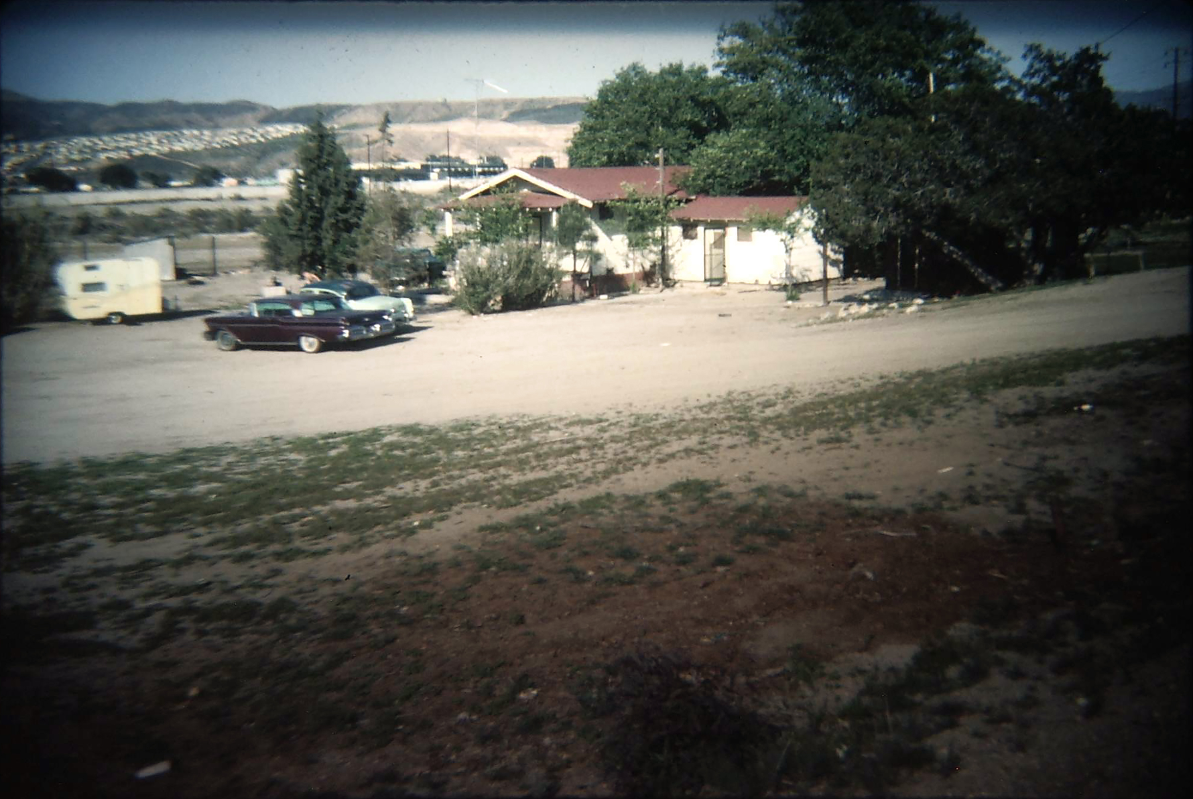
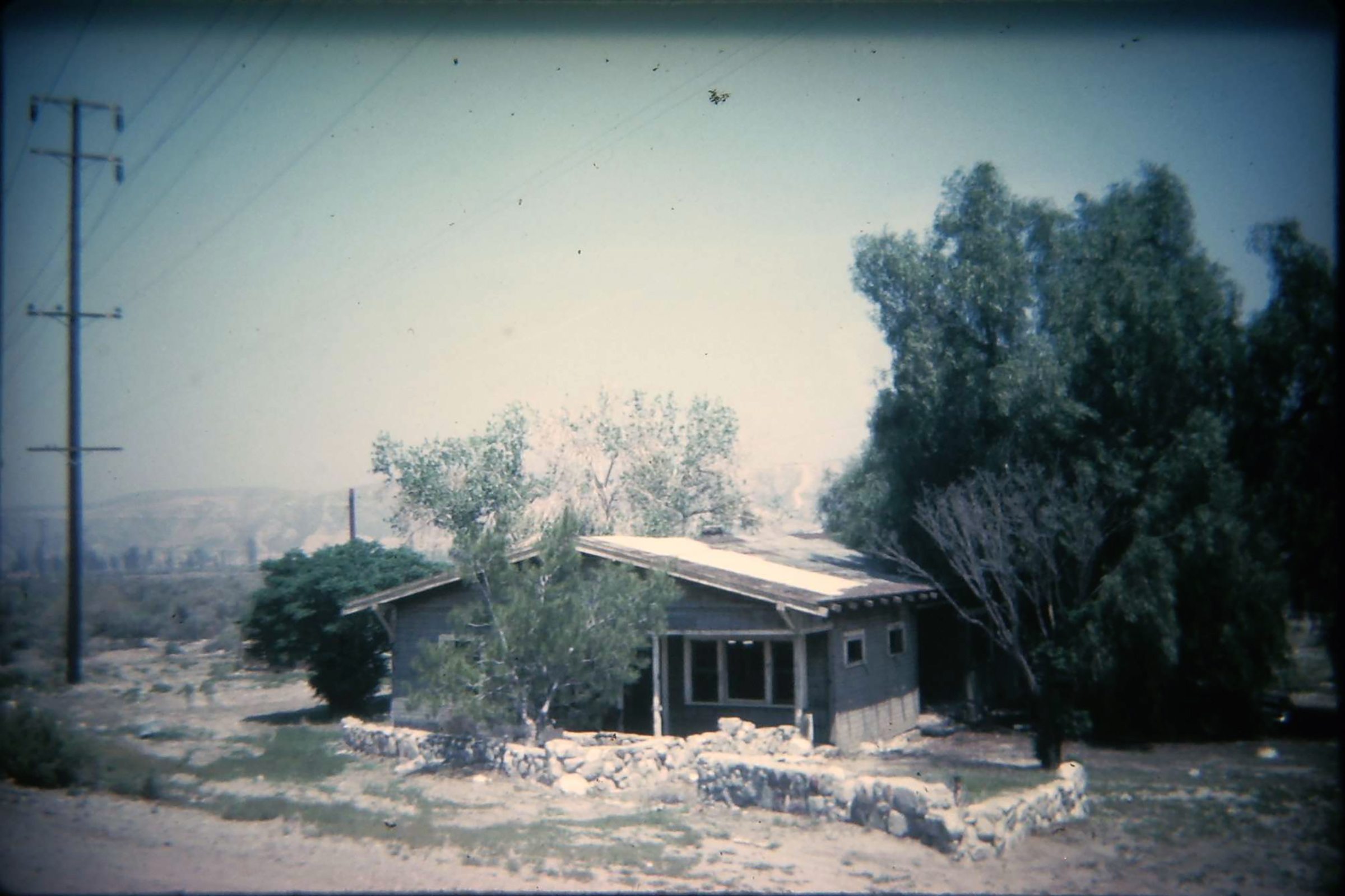
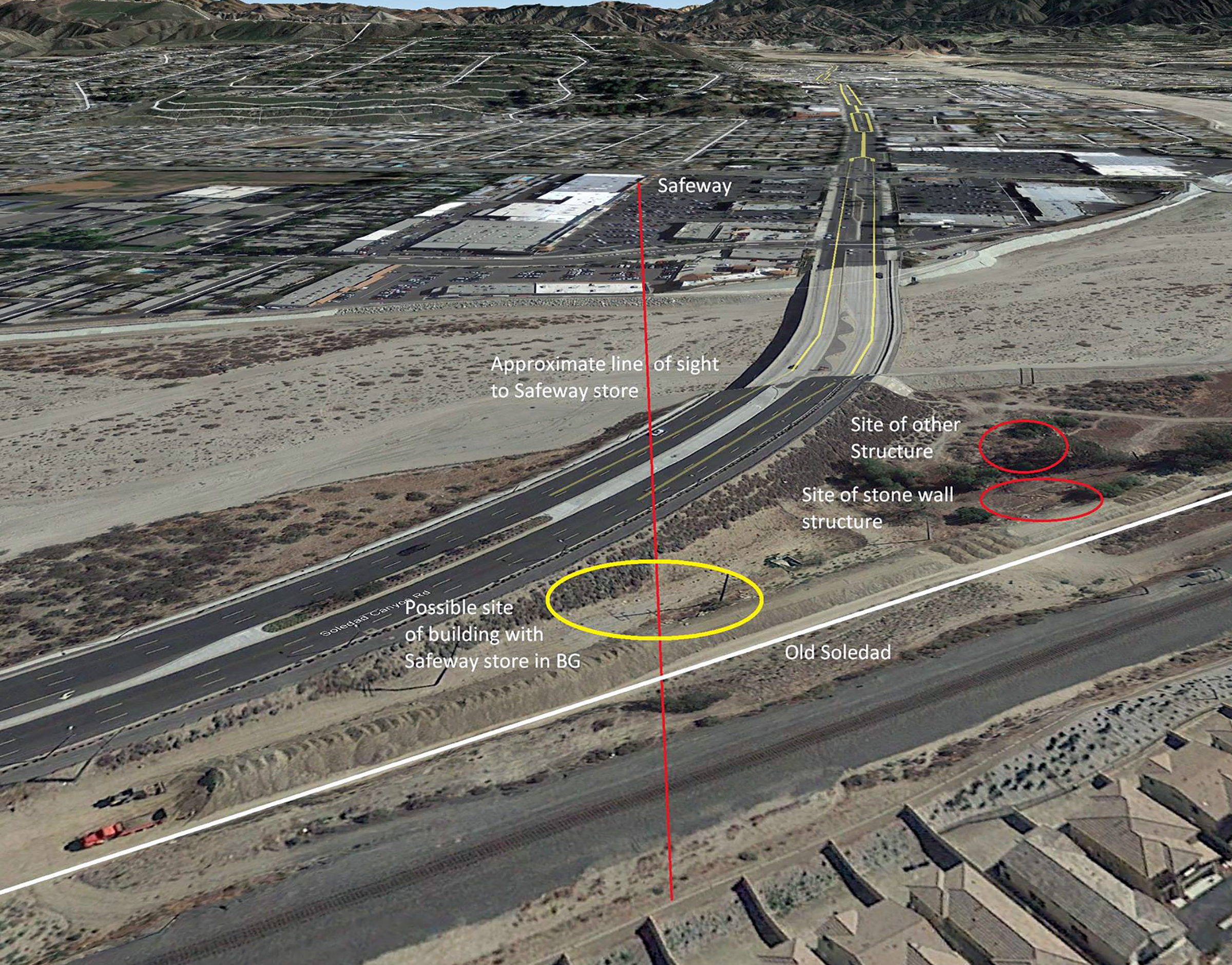
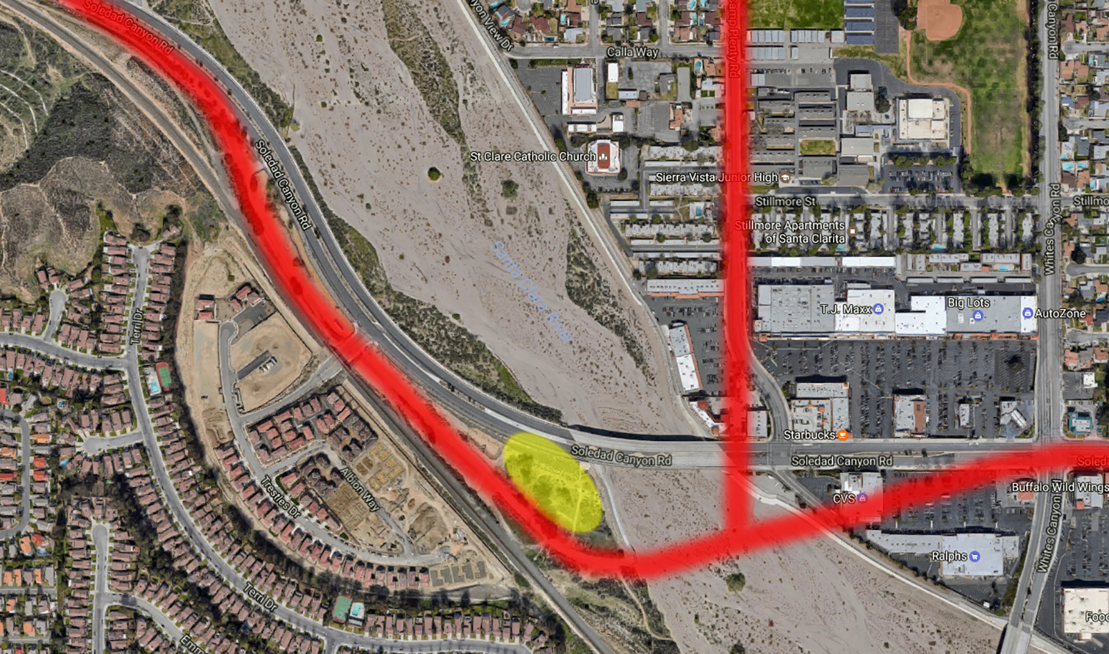
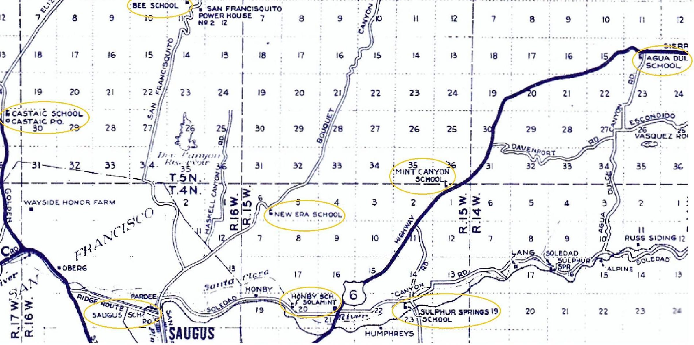
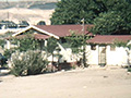
The original K-8 Honby School was active in the second quarter of the 20th Century. It was located on the southwestern bank of the Santa Clara River in today's Canyon Country, just west of the former wooden Soledad-Camp Plenty bridge abutment. See map at bottom. (According to highway historian Michael Ballard, the original river bridge, built in 1921 at a cost of $20,000, washed out in 1971. Soledad Canyon Road was reaigned and widened to four lanes in 1972.) The two images above (color transparencies), courtesy of Chris at JCM Digital Imaging, show structures that stood at the Honby School site location in about the 1960s. The remains of the rock wall in the second photo above are still visible in 2017. "I can vaguely remember driving past this structure on old Soledad before the floods washed the bridge out," Chris writes (pers. comm. 2017). "Just to the west of this building (location) are the remains, just a foundation, of another building which is encircled with large, old Peruvian pepper trees. I explored this area in the 1970s and early '80s and can remember rummaging through various building debris at these two sites." (Top photo): "Another building is shown in the same area where then multiple-arched Safeway store building can be seen in the background across the dry Santa Clara river bed." It's doubtful that either of these structures was the school building. Eleanor Fryer, who graduated from the eighth grade at Honby in 1940 (as Eleanor Haddock), said: "Neither of these look anything like the Honby School I attended. ... We had a one-room building, no side room attached" (pers. comm. 2017). Fryer said the Honby School she attended (since 1935) had been rebuilt in 1937, then it was swept downriver in the Great Flood of March 1, 1938. Whether it was then rebuilt at precisely the same location, we're unsure; regardless, the area shown in these two photos is where she graduated in 1940. See image below for locations of the bulidings in these two photos.
HB6001: 9600 dpi jpegs from color transparencies courtesy of Chris at JCM Digital Imaging. Online images only.
|
Honby Locator
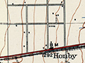
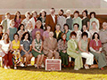
Student Body 1938
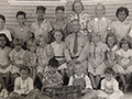
Student Body 1939
Structures ~1960s
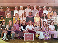
Staff 1974-75
6th Grade 1974-75
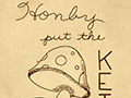
Cookbook ~1970s-80s
|
The site owner makes no assertions as to ownership of any original copyrights to digitized images. However, these images are intended for Personal or Research use only. Any other kind of use, including but not limited to commercial or scholarly publication in any medium or format, public exhibition, or use online or in a web site, may be subject to additional restrictions including but not limited to the copyrights held by parties other than the site owner. USERS ARE SOLELY RESPONSIBLE for determining the existence of such rights and for obtaining any permissions and/or paying associated fees necessary for the proposed use.
