|
|
The Fort Tejon Earthquake of 1857.
Harper's Weekly Journal Of Civilization (illustrated newspaper),
New York.
Saturday, February 21, 1857.
|
The last California mail brought the intelligence that, on the morning of the 9th of January, several severe earthquake-shocks were felt throughout the State, extending from San Diego to the north of Sacramento, and from the coast line to the upper valleys of the Sierra Nevada. It is estimated that no less than sixty shocks of earthquakes have occurred in California during the past five years, and the apprehension that they may be folIowed by still more terrible phenomena is by no means a pleasant reflection for the inhabitants of the State. From our latest files we make up a brief sketch of the extent and results of the recent visitation. Several curious points present themselves for scientific investigation.
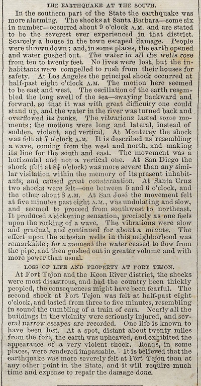
In the southern part of the State the earthquake was more alarming. The shocks at Santa Barbara—some six in number—occurred about 9 o'clock A.M. and are stated to be the severest ever experienced in that district. Scarcely a house in the town escaped damage. People were thrown down; and, in some places, the earth opened and water gushed out. The water in all the wells rose from ten to twenty feet. No lives were lost, but the inhabitants were compelled to rush from their houses for safety. At Los Angeles the principal shock occurred at half-past eight o'clock A.M. The motion here seemed to be east and west. The oscillation of the earth resembled the long swell of the sea—swaying backward and forward, so that it was with great difficulty one could stand up, and the water in the river was turned back and overflowed its banks. The vibrations lasted some moments ; the motions were long and lateral, instead of sudden, violent, and vertical. At Monterey the shock was felt at 7 o'clock A.M. It is described as resembling a wave, coming from the west and north, and making its line for the south and east. The movement was a horizontal and not a vertical one. At San Diego the shock (felt at 8¾ o'clock) was more severe than any similar visitation within the memory of its present inhabitants, and caused great consternation. At Santa Cruz two shocks were felt—one between 5 and 6 o'clock, and the other about 8 A.M. At San Jose the movement felt at five minutes past eight A.M., was undulating and slow, and seemed to proceed from southwest to northeast. It produced a sickening sensation, precisely as one feels upon the rocking of a wave. The vibrations were slow and gradual, and continued for about a minute. The effect upon the artesian wells in this neighborhood was remarkable; for a moment the water ceased to flow from the pipe, and then gushed out in greater volume and with more power than usual.
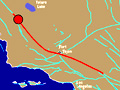
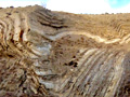
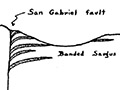
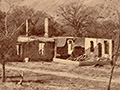
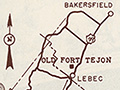
At Fort Tejon and the Kern River district, the shocks were most disastrous, and had the country been thickly peopled, the consequences might have been fearful. The second shock at Fort Tejon was felt at half-past eight o'clock, and lasted from three to five minutes, resembling in sound the rumbling of a train of cars. Nearly all the buildings in the vicinity were seriously injured, and several narrow escapes are recorded. One life is known to have been lost. At a spot, distant about twenty miles from the fort, the earth was upheaved, and exhibited the appearance of a very violent shock. Roads, in some places, were rendered impassable. It is believed that the earthquake was more severely felt at Fort Tejon than at any other point in the State, and it will require much time and expense to repair the damage done.
Newspaper images: 9600 dpi jpeg of 300 dpi jpg of original newspaper from the collection of Alan Pollack
|
Video: Field Guide to the San Andreas Fault
1857 Fort Tejon Quake
Fault in Palmdale
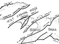
Geology of Canyon Country (Dort 1948)
Strike-Slip Displacement (Crowell 1954)
Winterer & Durham 1962
Castaic Geology (Stitt 1981)
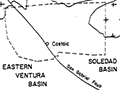
Soledad Basin (Muehlberger 1954)
Inventory of State Park Collection
Self-Guided Tour 1996
Huell Howser Program 1999
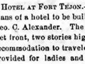
Hotel Plan 1858
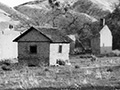
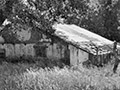
Ruins (Mult.)
Rancho La Liebre 1929 (Story)
Postcard 1930s
Flying A Gasoline 1938
Home Movie 1939
Book: Old Adobes (Cullimore 1949)
Travelogue 1949
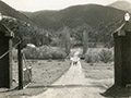
Old Gate Pre-1950
Officers' Quarters ~1950s
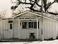
Headquarters Bldg. 1957 (Story)
Brochure Pre-1967
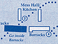
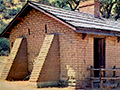
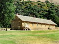
Enlisted Men's Barracks (Mult.)
• 1857 Earthquake (1)
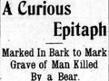
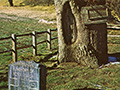
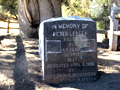
Peter Lebeck Exhumed 1890
Lebeck Story 1901
Lebeck Grave 1957 (Story)
Lebeck Oak ~1960s
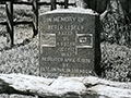
Lebeck Oak & Grave Marker x7
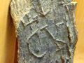
Lebeck Bark x2
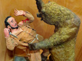
Lebeck Sculpture x3
|

The site owner makes no assertions as to ownership of any original copyrights to digitized images. However, these images are intended for Personal or Research use only. Any other kind of use, including but not limited to commercial or scholarly publication in any medium or format, public exhibition, or use online or in a web site, may be subject to additional restrictions including but not limited to the copyrights held by parties other than the site owner. USERS ARE SOLELY RESPONSIBLE for determining the existence of such rights and for obtaining any permissions and/or paying associated fees necessary for the proposed use.
