|
|
McBean Parkway Before Henry Mayo Hospital
Valencia, California
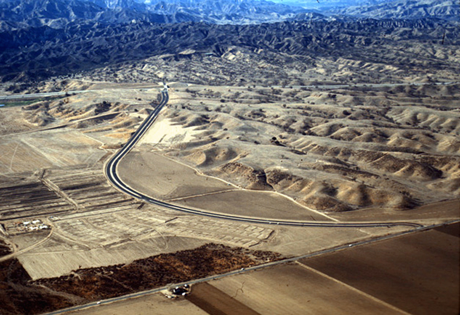
Click image to enlarge Newly constructed McBean Parkway, probably 1968 or early 1969. At center is the 25-acre graded pad donated by The Newhall Land and Farming Co. for the future Henry Mayo Newhall Memorial Hospital. At top (west) is the recently completed Interstate 5, which replaced old Highway 99 (aka The Old Road). To the left (south) at the tip of the bow-out is the future Orchard Village Road. At bottom is Newhall Avenue, which used to go through. Out of frame to the right (east) of Newhall Avenue was the Newhall (aka Saugus) airport. The latest possible date for this image is May 3, 1969, when California Institute of the Arts broke ground. There's no sign of it. Further reading: Volunteers Pave the Way to Henry Mayo Hospital.
TN6901: 9600 dpi jpeg |
The site owner makes no assertions as to ownership of any original copyrights to digitized images. However, these images are intended for Personal or Research use only. Any other kind of use, including but not limited to commercial or scholarly publication in any medium or format, public exhibition, or use online or in a web site, may be subject to additional restrictions including but not limited to the copyrights held by parties other than the site owner. USERS ARE SOLELY RESPONSIBLE for determining the existence of such rights and for obtaining any permissions and/or paying associated fees necessary for the proposed use.
