|
|

A Tale of Two Ribbons.
Lady Linda Ties Yellow Ribbon; City Cuts Red Ribbon to Open Space.
October 10, 2018.
|
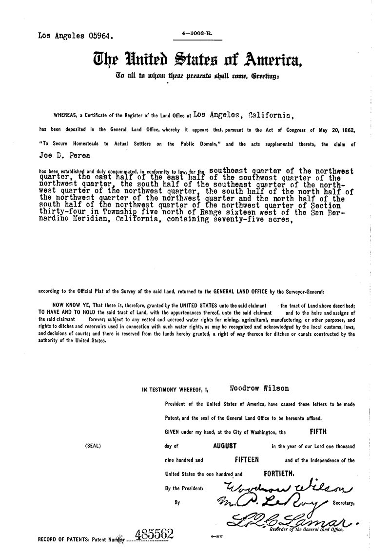
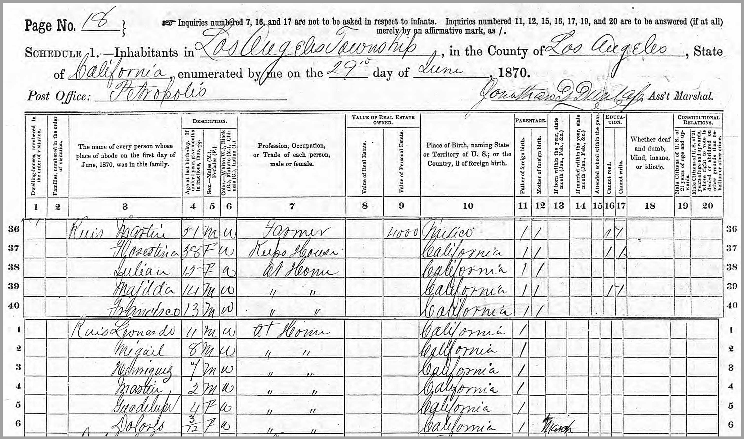
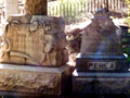
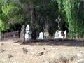
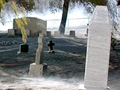
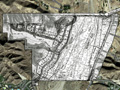
October 10, 2018 — Charles F. "Chuck" Cullen Jr. points out the remnants of the yellow ribbon that his stepmother, Lady Linda, tied around the old oak tree 45 years ago when she married his father. It's just a hop and a skip from the entrance to the city of Santa Clarita's newly acquired San Francisquito Open Space, where Mayor Laurene Weste and members of the City Council cut a big red ribbon Wednesday. The oak tree stands along Lady Linda Lane at northeastern edge of the city's 176-acre property, which is entirely outside city limits at the mouth of San Francisquito canyon. The county of Los Angeles had approved a 50.9-acre section of the property for 37 single-family homes in 2008, but then the recession hit. The housing project was resurrected in 2014-2015, but the developer, Suncal Cos., couldn't get an agreement for water service. The landowner, Tesorito LLC (Andres and Aldo Flores of Compton), subsequently offered the property for sale to the city, which used $1.55 million from its Open Space Preservation District to buy it. "We became aware of the property a few years ago when we tried to purchase the property at a bankruptcy auction," Carrie Lujan, the city's public information officer, said at the time. "It has been on our radar ever since." Formed in 2007 and funded through a special property assessment, the Open Space Preservation District has been creating a "greenbelt" of permanently preserved parkland around the city by purchasing land that could otherwise be developed. At one time, the city's newest open space was part of the Ruiz-Perea compound in San Francisquito Canyon. The Ruiz and Perea families dominated the mouth of the canyon in the late 1800s and early 1900s. In 1928, six members of the Enrique R. "Henry" Ruiz family were killed in the St. Francis Dam disaster and buried in the Ruiz-Perea family cemetery, which is located on private property several hundred yards north of the city's open space. A patchwork of homesteaders once owned various portions of the city's open space, but the "sweet spot," 75 central acres, were homesteaded in 1915 by 25-year-old Joseph D. Perea. The land had actually been in the Perea family much longer. Joseph's father, Ramon, was born August 31, 1838, when California was under Mexican rule. Around 1855, Ramon became the first modern "discoverer" of oil in Pico Canyon. (Local Native Americans had known about Pico's oily springs for a thousand years.) Ramon's wife, Antonia, became the first burial in the Ruiz-Perea cemetery in 1888. The 1910 U.S. Census shows Joseph Perea and his wife, Anita C., 18, living where the city's open space is. Immediately north of them was the Henry Ruiz family on what is known today as the Keatley property. Henry Ruiz's wife, Rosaria, a flood victim, was Joseph Perea's sister. North of the Ruiz property lived the patriarch, Ramon, then 71, with another daughter and son-in-law. According to the 1910 Census, Ramon spoke Spanish; Joseph, English. Both were farmers. Ramon died January 25, 1915, and was buried in the Ruiz-Perea cemetery. Joseph Perea then moved his wife and children to the city of San Fernando. It was a good move. Else they, too, probably would have perished in the 1928 flood. Lady Linda enters the scene in 1940. Niece to flood victim Henry Ruiz (her mother, Guadalupe Ruiz Dominguez, 1866-1947, was Henry's sister), Linda was raised on the Dominguez family ranch near Piru. (Linda's father, Francisco, was a Dominguez.) Linda came to San Francisquito Canyon by way of Montebello with her first husband, Anthony R. "Tony" Packard, a cement contractor who would build the Lady Linda Ranch. Linda later married Charles F. "Fred" Cullen Sr. Some family members still live on the Lady Linda Ranch, which abuts the city's open space.
Click to open original .pdf
LW3435: Download original images here.
|
Enrique (Henry) & Rosaria Ruiz
Ruiz Family x7
Perea (Founder)
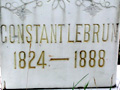
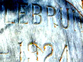
Constant LeBrun
Gus LeBrun Marker & Death Certificate
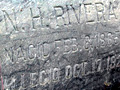
Nick Rivera
Leonardo Cesena
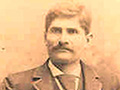
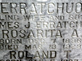
Erratchuo 1928
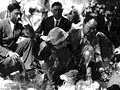
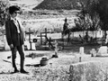
1928 Mourners
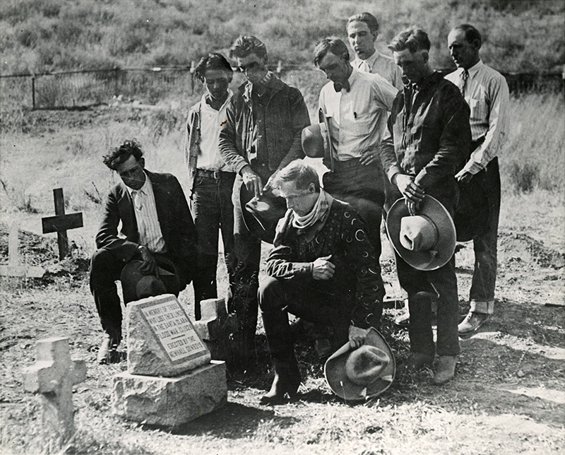
Newhall Cowboys 1928 Marker x2
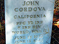
Johnny Cordova
1963 Mabel Packard Wagner Visit x5
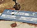
Fred & Frances Cooke
Harry S. Chacanaca
Pre-2002 Fire
2002 Copper Fire x10
Raw Video ~2004
Tesoro Extension 2015
City Open Space 2018
|

The site owner makes no assertions as to ownership of any original copyrights to digitized images. However, these images are intended for Personal or Research use only. Any other kind of use, including but not limited to commercial or scholarly publication in any medium or format, public exhibition, or use online or in a web site, may be subject to additional restrictions including but not limited to the copyrights held by parties other than the site owner. USERS ARE SOLELY RESPONSIBLE for determining the existence of such rights and for obtaining any permissions and/or paying associated fees necessary for the proposed use.
