|
|
Castaic Junction | St. Francis Dam Disaster
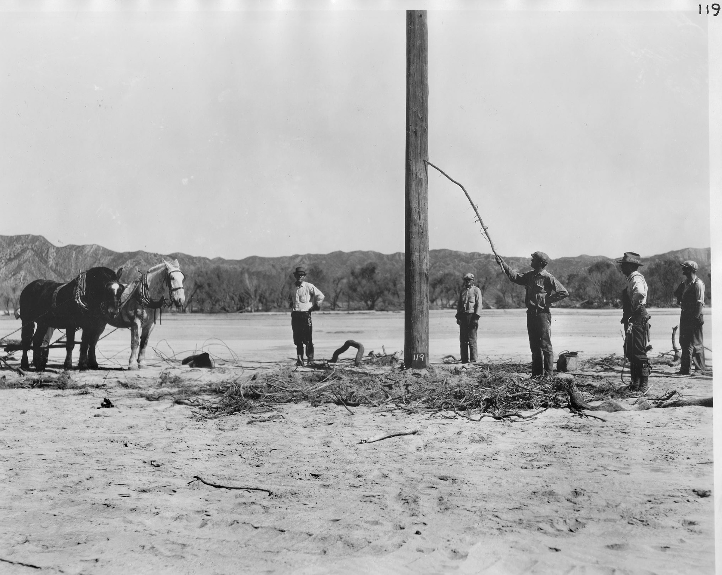
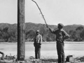
Click image to enlarge According to St. Francis Dam historian J. David Rogers, the original LADWP caption to this photo is: "High Water Mark of 11 feet near Oberg Siding." (Scroll down.)
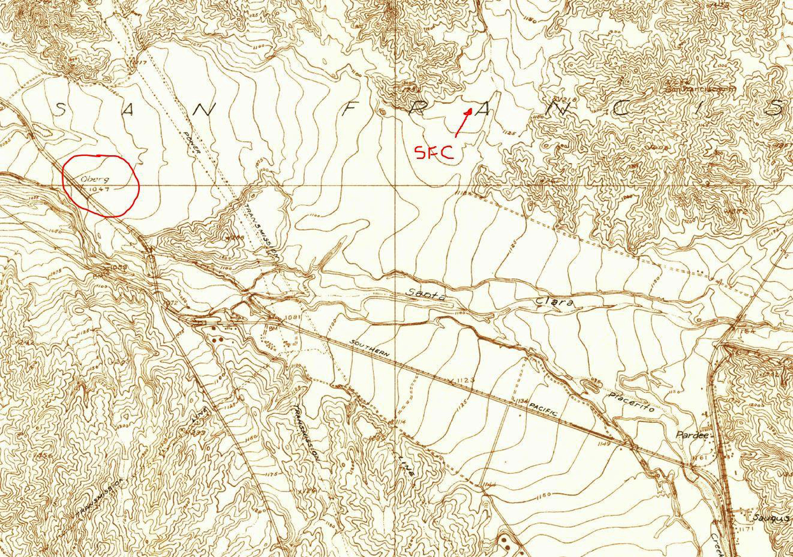
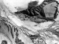
Click image to enlarge. A 1929 USGS topographical map, courtesy of Jason Brice, places Oberg (circled) at the northwest end of Castaic Junction. (It's roughly the upper-left corner of this aerial photo.) Here, "SFC" is pointing to San Francisquito Canyon.
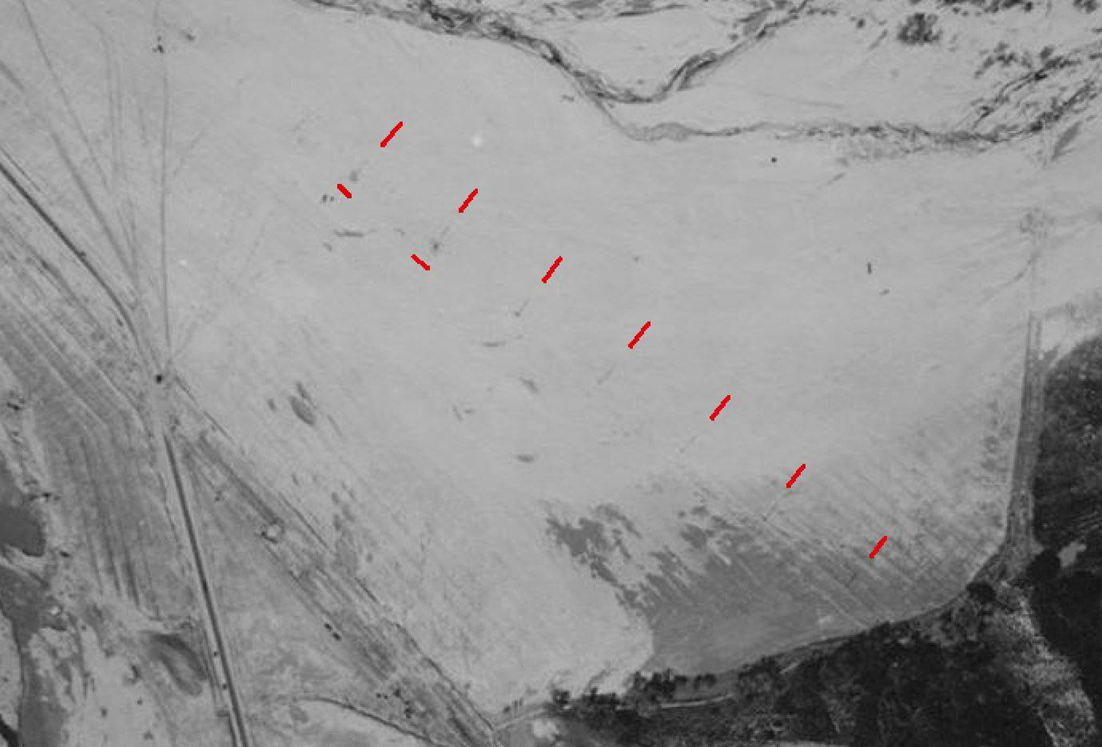
Click image to enlarge. Magnifying the upper-left corner of one of these aerial photographs, Jason Brice points out evenly spaced power or telephone poles in the vicinity of the Oberg Siding at Castaic Junction and suspects the men in the High Water Mark photo are gathered around one of them.
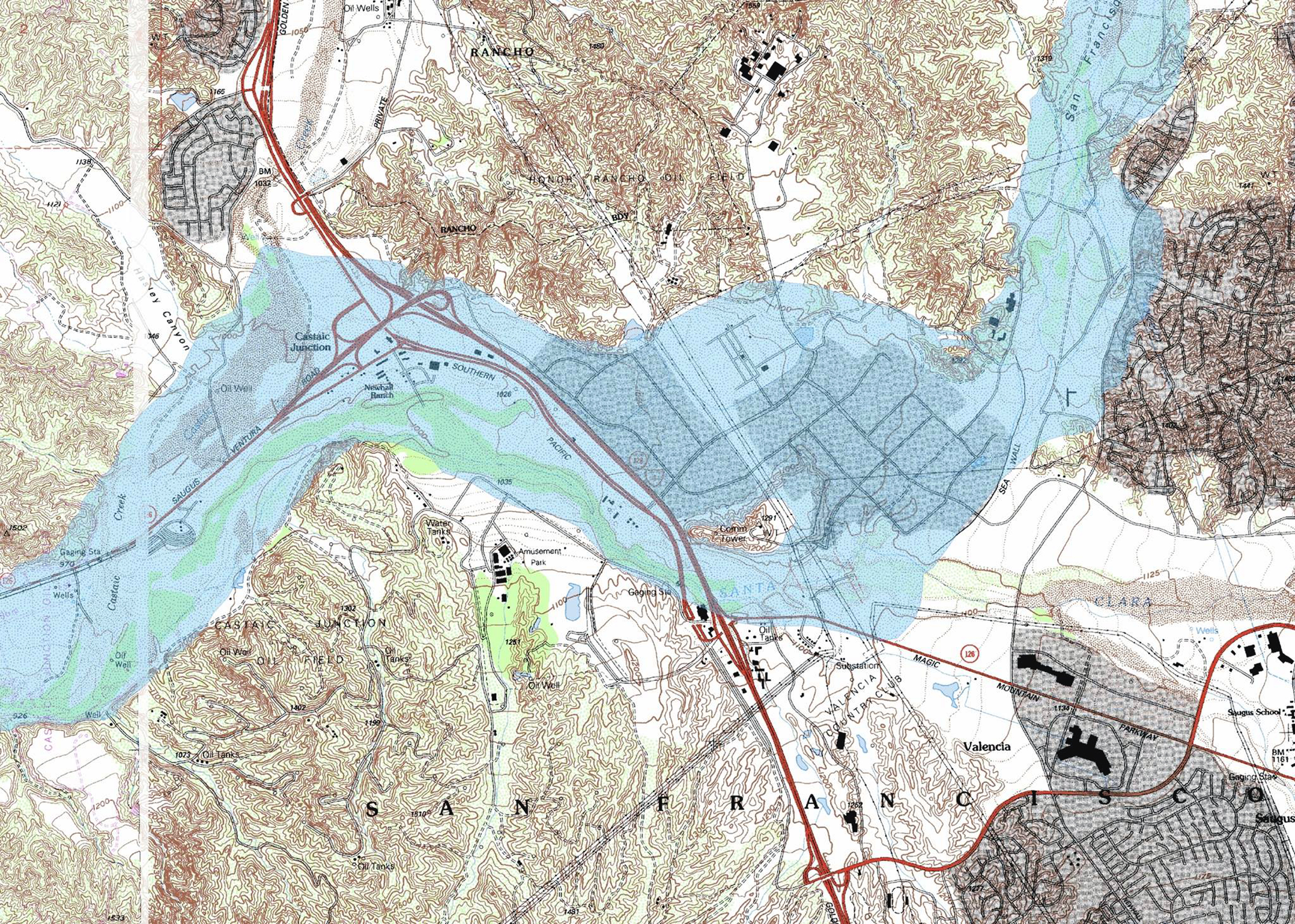
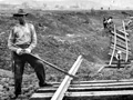
Click image to enlarge. J. David Rogers writes (2014): Here is a clip from my flood inundation map of (the Castaic Junction) area. The flood waters diverted around the north side of the promontory would have swept in from the east, nearly perpendicular to that tracks in vicinity of Oberg Siding, and the erosion would have been severe along the oversteepened banks along the eastern side of the Santa Clara River Channel, which is noticeably incised. That explains how the tracks shifted 200 feet to the west.
RO2803c: 19200 dpi jpeg. Online image only. |
Flood Path Aerials x3
High Water Mark
SPRR Tracks Moved
SPRR Track Erosion
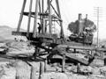
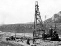
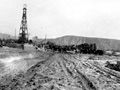
Highway Pile Driver
Highway Pile Driver
Highway Pile Driver
|
The site owner makes no assertions as to ownership of any original copyrights to digitized images. However, these images are intended for Personal or Research use only. Any other kind of use, including but not limited to commercial or scholarly publication in any medium or format, public exhibition, or use online or in a web site, may be subject to additional restrictions including but not limited to the copyrights held by parties other than the site owner. USERS ARE SOLELY RESPONSIBLE for determining the existence of such rights and for obtaining any permissions and/or paying associated fees necessary for the proposed use.
