|
|

Mining and Ranching in Soledad Canyon and Antelope Valley.
| January 8, 2003.
|
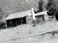
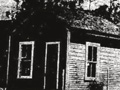
Webmaster's note: David Earle is an ethnographer in the Department of Anthropology at Antelope Valley College. HISTORICAL OVERVIEW OF EURO-AMERICAN SETTLEMENT AND ECONOMIC ACTIVITIES IN AND NEAR THE LITTLE ROCK CREEK WATERSHED 4.1 INTRODUCTION After the middle of the nineteenth century the Little Rock Creek watershed region and project area were incorporated into the expanding zone of Euro-American permanent settlement. This section of the overview discusses the impact of this settlement and related economic activity on the watershed. The most important activities affecting the Little Rock Creek drainage and adjacent areas during the 1850-1890 era included mining, squatting/homesteading, transportation, and stock grazing. The project area within the watershed saw the establishment of several facilities: the Palmdale Ditch inlet maintenance house, the Little Rock Dam complex, and a cabin in Santiago Canyon. However, most historical use of the watershed project area outside of the dam site developed on a more transient basis. Stock grazing and grazing camps, hunting and hunting camps, prospecting sites and camps, trails, bee keeping facilities, and bandit campsites constitute some of the kinds of human activity areas that can be associated with these more transient or seasonal uses. A number of farmsteads and mines were established immediately adjacent to the watershed project area (within a distance of 3 miles [5 km] from the project boundaries). By 1915, over a dozen of these were located to the west, north, and east of the project area. Various activities carried out by the occupants of these adjacent properties, including prospecting and mining, stock grazing, bee keeping, and hunting, directly involved the project area itself. We have included the settlement of these adjacent areas as part of our historical overview. We have also outlined the processes of regional economic and social development affecting the southern Antelope Valley and the Soledad Canyon regions after 1850. These processes shaped the evolving use of the watershed project region and adjacent areas. It is important to keep in mind that the advent of Euro-American settlement in the region brought with it impacts on the natural environment of the project area. These included the introduction of non-native grasses and other plants, the heavy hunting of local fauna, damage from human-caused wildfires, and the introduction of other new elements in local ecosystems such as the European honeybee. While the project area itself did not become the site of intensive farm cultivation or mining, it was nevertheless impacted by settlement of this frontier area after 1850. The most important activities affecting the Little Rock Creek drainage and adjacent areas during the 1850-1890 era included mining, squatting/homesteading, transportation, and stock grazing. The first formal steps to effectively incorporate the Antelope Valley frontier region into the zone of Hispanic settlement in Mexican California were taken in the early 1840s. Several rancho land grants were made in the westernmost end of Antelope Valley in the late 1840s. In addition, it has been suggested that Francisco Chari had settled in Bouquet (originally Buque) Canyon as early as 1843, having previously herded cattle in that area for Chico Lopez. The Mexican rancho land grants in the southwestern Antelope Valley were not really brought into economic production until after the American conquest in 1846, however. During the first years of the California gold rush the southern Antelope Valley and the northern slopes of the San Gabriel Mountains remained a remote frontier zone without permanent non-native settlements. William Manley and John Rogers trekked out of Death Valley in early 1850 to seek help for emigrants stranded there, in a famous Gold Rush era incident. They camped at Barrel Springs, several miles to the west of Little Rock Creek, before heading down to the Santa Clarita-Saugus area. At that time the frontier of permanent Euro-American settlement was still situated at the lower end of the aptly named "La Soledad" Canyon, around modern Canyon Country. This was the desertward edge of the Rancho San Francisquito. Manley and Rogers then returned on foot to Death Valley to bring the Bennett-Arcan party out to safety via the same route. Manley's account of this ordeal mentions no permanent Euro-American settlement in the valley, although there were signs that Barrel Springs had been used by Native livestock raiders. The account does, however, mention that a crude trail, which had existed in San Francisquito Canyon during the Mexican era, was being, with difficulty, improved for wheeled wagon traffic. This road was being promoted as a means for gold-seeking argonauts arriving at Los Angeles via the Santa Fe Trail and other lower routes to get to the northern gold fields. The imposition of American rule and the Gold Rush were to lead to permanent settlement of the southwestern corner of the Antelope Valley during the 1850s. Settlement in the area was associated with the economic development of rancho land grants and other grazing holdings and with the development of roads to mines, settlements, and military installations in the Tehachapi Mountains and southern San Joaquin Valley regions. This settlement was spurred by Gold Rush-related immigration and the activities of prospectors attempting to develop new mining areas in southern California. In addition, the cattle price boom created by Gold Rush demand for beef in northern California caused a push to expand cattle production on the southern ranchos, including those on the frontier. This boom period, however, was beset by insecurity of life and property, as the rising value of cattle resulted in increasing stock theft in southern California. Young Spanish-speaking Californios displaced and disgruntled by the American settler invasion, as well as adventurers and riff-raff converging from the north and east proceeded to raise considerable hell in California during the 1850s. An additional related phenomenon was the continuation of native stock raiding into the heart of Southern California, as previously discussed. The native raiding virtually paralyzed the stock raising efforts on the ranchos in the Santa Clarita valley and the edge of the western Antelope Valley during the years immediately preceding 1854. Stock had to be withdrawn from Rancho San Francisquito, and the San Fernando mission land owners saw stock stolen from there as well. In response to this emergency, in 1853 the San Sebastian Indian Reservation was established by Edward F. Beale in the southeasternmost corner of the San Joaquin Valley. The following year, Fort Tejon was established in the Cañada de las Uvas to protect frontier settlements and mining operations in the Tehachapis and southern Sierras from native attacks and vice versa. These measures helped to ease the crisis, although they did not eliminate it. In 1854 a gold strike was made in the Kern River area of the southern Sierras, leading to the first settlement of the Tehachapi area by prospectors and farmers. The San Francisquito wagon road was used by Phineas Banning and others as a freighting route to supply Fort Tejon. A considerable settlement of civilians developed in the vicinity of the fort as a consequence of the influx of salary and supplies money into the region. The Antelope Valley and Little Rock Creek areas were visited in 1853 by an army survey party dispatched to California by Secretary of War Jefferson Davis under mandate from Congress. The party, commanded by Lt. Williamson, was charged with surveying possible routes for the southern California leg of a proposed transcontinental railroad. Williamson's party was to examine possible pass routes by which a railroad could be built from the San Joaquín to the Antelope Valley and from the Antelope Valley to Los Angeles. After surveying possible routes through the Tehachapi mountains, elements of the party passed along the southern foothills of the Antelope Valley from the modern Gorman area to the vicinity of present Palmdale. At that date, 1853, no permanent settlement in the Antelope Valley was observed. However, later that year a Sonoran family was described as settled at Elizabeth Lake by travelers to Fort Tejon. This family was said to have represented an absentee ranchero owner- he might have been the grantee of Rancho La Liebre. In any case, a later account mentions that at around this time an adobe structure was built near a place later called Neenach in southwestern Antelope Valley by the owner of the Liebre land grant. These appear to represent the first permanent non-native settlements within the Antelope Valley/northern San Gabriel Mountains region. Members of the Williamson Railroad Survey party did visit the Little Rock creek area in 1853. The survey party entered the Antelope Valley from the west. It proceeded to explore San Francisquito and Soledad canyons, evaluating them as possible railway routes to Los Angeles. The expedition then passed east to the Mojave River. William Blake, expedition geologist, then doubled back towards Soledad Pass. He visited and described the lower reaches of Little Rock Creek canyon. Blake noted: From the copper-ore locality, I passed [west] along the foothills, and followed up the dry bed of a stream towards the mountains. It was evident that at certain seasons a very large body of water ran there, as the channel was strewed with large rounded masses of rock, which were mostly of granite and were piled together in confusion. A grove of cottonwood trees was also visible some distance up the channel, and contrasted strongly with the brown and barren-looking hills on each side. On nearing this grove, indications of water were observed, and several deep pools were found at the base of an almost vertical wall of sandstone strata, which were inclined at a high angle, and surmounted by layers of drift sand and gravel... It was evident that the water was much higher at certain seasons, and that it flowed with a strong current, it having worn caverns and deep hollows in the strata. ... This stream was afterwards named Cottonwood Creek, for the abundance of cottonwood near its sources (Blake 1856:66). Before reaching Soledad Pass, Blake and other members of his party apparently blundered a considerable distance up Hunt Canyon, just to the west of Little Rock Creek. Blake there reported finding large number of agate nodules there, some of which were hollow and contained quartz crystals. Shortly after the exploration of the valley by the Williamson expedition, another rancher became interested in the Antelope Valley area. This was Francisco "Chico" Lopez, whose earlier interests in the region we have mentioned above. Chico Lopez established a ranch site to the southeast of Elizabeth Lake (also called La Laguna de Chico Lopez), probably at the upper end of the Ana Verde Creek-Leona Valley drainage. One of our important native sources about Little Rock Creek, the Fernandeño named Septimo we have previously referred to, evidently worked as a drover for Chico Lopez in that region. In his interviews with John P. Harrington, Septimo referred to a place called the "llano verde" (green plain), also referred to as the "llano de Chico Lopez", which was in the Leona Valley area and gave its name to modern "Ana Verde" Creek. In 1853 the process of surveying the public lands of the Antelope Valley and adjoining San Gabriel foothills was begun by the U.S. General Land Office. The surveying of all California public lands, that is, lands not granted in title by the Spanish or Mexican governments, was a first step in the opening of these lands up to legally-sanctioned settlement. In 1855 Henry Hancock surveyed the Little Rock Creek drainage northward from Section 14 in Township T5N, R11W, S.B.B.M., near the point where the creek emerges into the desert near Littlerock. The watershed area just to the south and adjoining the modern National Forest boundary, however, was not surveyed until the end of the century. The process of land survey, the information the surveys yielded about the natural environment and settlement, and the relationship of the surveys to homesteading will be dealt with more fully in a later section. 4.2 THE SOLEDAD-ACTON REGION AND MINING DEVELOPMENT After 1853 the uppermost end of the Santa Clara River drainage and the mountain zones on either side of it saw the beginnings of organized mining activity. This, along with early ranching developments referred to above, marked the commencement of non-native exploitation and settlement of the northern slopes of the San Gabriels. Copper prospecting and mining were among the first mineral exploitation activities in the region. The Williamson railroad survey party had observed, in the Ravenna area of the Soledad Canyon/Santa Clara River drainage, signs of the beginnings of working of a copper vein in 1853. The Hancock land survey of 1855 had also noted indications of copper approximately 3/4 mile to the north of the later site of Totem Pole Ranch. In September of 1857, two miners named C.R. Worland and P.P. Hutchings recorded a copper mining claim between Soledad Canyon and Little Rock Creek. This mining claim was described as follows: Situated about one mile east of the head waters of a large cañon (said to be the Santa Clara) and beginning west at or near a small live oak tree upon the eastern side of a ravine and near a large cluster of palmettos in the same ravine. Thence running east over the hills to another ravine near a large creek that empties into the Mohave Plain (name not known but called by us Cotton Wood) together with all of its dips and angles for for the space of 100 yards both north and south of said vein for the purpose and convenience of working the same. (L.A.C.C.R.O. Preemptions 1:96-97) Given this rather vague description, the location of the claim is difficult to pinpoint exactly. Its westernmost end would appear to have been situated a mile to the east of either the northerly or southerly branch of the headwaters of the Santa Clara River, thus somewhere in upper Hunt Canyon. The description of vegetation given and the topography of the region between Hunt Canyon and Little Rock Creek suggests that the claim was located in Sections 28 and 29 in Township T5N, R11W, S.B.B.M., to the northwest of Little Rock Reservoir. This is the first record that we have of Euro-American activity in the National Forest portion of the Little Rock Creek watershed. In the summer of 1861 the copper deposit in the Soledad Canyon which the Williamson Survey had seen evidence of being worked was rediscovered. The excitement that this created led Los Angeles merchant Don Manuel Ravenna to organize a Soledad Mining Company to exploit the find. Soon gold and silver were also found at this strike. Shafts were sunk in late 1861, and the Soledad Mining District was organized. Over $300,000 was invested in the mines there. During this initial boom, Angelenos wrestled with the difficulties of supplying the mines, since the notorious Fremont Pass had still not been substantially improved for wheeled traffic. A primitive settlement, variously called Soledad and Ravenna, grew up at the mine site. In the course of 1862, after hundreds of feet of tunnels had been dug, it was discovered that the copper veins were not substantial enough to yield paying quantities of ore. The copper operations were suspended. A substantial number of Mexican or Californio miners were thus thrown out of work. They, however, returned to their traditional gold mining when they found gold-bearing quartz in the vicinity and proceeded to establish some ten milling arrastres. With this, interest in the area gradually revived, and by 1863 a substantial number of small-scale gold mining operations had been set up by Anglo miners as well. During this new burst of activity, copper deposits near Little Rock Creek were filed on. In June of 1863 the Los Angeles press reported that near Barrel Springs, to the west of "Rock Creek", a new copper deposit had been located. Two 50 foot shafts had been sunk for two mines-the Queen of the West and the Pacific. By late 1864, this second boom had cooled, leaving the field largely to the Spanish-speaking miners again. The population of Soledad/ Ravenna dwindled. In early 1868, yet another gold excitement brought more miners to the area. Steam-powered stamp mills were erected, and substantial tunneling was done at several of the mines. This activity, at one time employing at least 200 men, continued through 1870. The 1870 U.S. Decennial Census counted a total of 265 individuals in the region encompassing modern Newhall/Santa Clarita, Soledad Canyon, San Francisquito, Elizabeth Lake, and Gorman. The majority of these were located in the Soledad canyon mining camps, since the town of Newhall did not yet exist. In the course of that year, major operations were again suspended. 4.3 STOCK GRAZING IN THE SOLEDAD CANYON-LITTLE ROCK CREEK REGION The project region began to develop in the era after 1850 as both a mining and a stock raising frontier. Cattle raising was the predominant agricultural activity in northern Los Angeles County during the 1850s, with the active northern California market keeping prices up for much of the decade. The depredations of both native raiders and stock rustlers, discussed previously, was a menace to the industry during this period. In the late 1850s and early 1860s small graziers began to settle in the San Francisquito Canyon and Elizabeth Lake areas. A major impetus to grazing in the region was the terrible drought of 1862-1865, which devastated the southern California cattle industry. Owners of herds on the coastward side of the San Gabriels frantically searched for new areas of pasture. The San Gabriel Mountains high country was then brought under use for the first time as a grazing area for stock owners, although it had for years been used to pasture stolen stock (Robinson 1991:21). This was done despite the risk of grizzly bear attack. Chilao, Horse Flats, Barley Flats, and Pine Flats near Crystal Lake were used to graze cattle in the 1860s and 1870s. Two areas were mentioned as providing pasture for cattle on the desert side of the range. The first was Prairie Fork, at the head of the East Fork of San Gabriel River. Cattle were brought over Blue Ridge from Lone Pine Canyon and down into Prairie Forks. The second area was the Little Rock Creek drainage (Robinson 1991:21). Sheep herding had existed in 1850 as only a very minor adjunct to cattle raising. By 1860, the industry had grown substantially. Los Angeles County agricultural census data for 1860 indicated a total of circa 100,000 head of sheep. During the 1860s the wool industry in the state as a whole increased fivefold (Cleland 1941:139). The Civil War brought a partial cutoff of cotton supplies and a huge increase in demand for wool, causing a steep climb of wool prices. As a result of this boom and the disastrous droughts of the early 1860s, sheep herding surpassed cattle raising as the dominant industry in southern California for a time. Many rancho owners believed that sheep grazing would turn out to be a more drought resistant industry than cattle raising. French and Basque personalities played a prominent role in this, as many coastal and even more interior ranchos were converted to sheep production. This was an activity that required, of course, skilled manpower in the managing of lambing. The Santa Clarita and Antelope Valleys and surrounding mountains were certainly affected by the development of this new grazing regime. In the 1860s, Chico Lopez ran sheep in the Elizabeth Lake- Leona Valley region west of modern Palmdale. During the 1860s and 1870s herds of sheep belonging to E.F. Beale's vast Tejon Ranch could be found in the western Antelope Valley. These were crowded into protective corrals at night against the threat of grizzly bear attack (Nordhoff 1875:234-237). A traveler, passing through Elizabeth Lake, west of Palmdale, in 1874 noted the following: There are many large cattle ranches in the vicinity of this place, and the plains are covered with bands of sheep. After leaving the lake, we traveled many miles across the plains until we arrived at the Lievre [sic] ranch, which is one of the largest sheep ranches in the country (Los Angeles Herald 8/12/1874) We have mentioned the droughts of 1871-1872 and especially that of 1876-1877, which had serious impacts on sheep grazing in southern California. Cleland (1941:209) mentions an attempt by a coastal grazier to move 18,000 sheep from the coast to upper Soledad Canyon during the 1876-77 drought. It is said that the sheep died on the way. This is an indication of the use of this area for sheep grazing during this period. Areas of the adjacent Little Rock Creek watershed were also used for summer sheep pasture. The highland area at Chilao, behind the Little Rock Creek watershed, was used to pasture sheep, according to pioneer Arthur Carter. The latter recalled bonfires being maintained at night there to keep the mountain lions away from the sheep. He noted that herds of sheep were brought up from the northern foothills of the San Gabriels to Chilao via Little Rock Creek in the summer of 1894 by "Spanish" herders (Carter 1938). Another place associated with sheep grazing was Sheep Camp Spring. The latter place is located within the project area and on the Soledad Canyon trail, to the southeast of the head of Soledad Canyon and to the northwest of Pacifico Mountain. Sheep operations are also indicated by the 1880 census of Soledad Township, which mentions stock raisers and shepherds in the region. These operations may have been centered in the Castaic Canyon area north of modern Saugus, but grazing was also carried out elsewhere in the township. Particularly in the interior areas of southern California, the grazing of sheep was seen as a real threat to local plant communities and watersheds, given the sheep's habit of cropping of vegetation at ground level. The more xeric conditions and more fragile plant cover in the interior made sheep damage harder to repair. In addition, shepherds in the 1870s and 1880s were often accused of starting wildfires in the mountains and foothills to destroy chaparral growth in favor of open grasslands. A disastrous and massive fire that burned over the Soledad Canyon watershed in 1884 was blamed on burning by stockmen (Lockmann 1981:108). The limits of viability of this regime in the interior had induced the Tejon Ranch to switch to cattle production in the wake of the drought in the late 1870s. Cattle ranchers were not terribly happy, of course, to have their animals competing with sheep over range grasses, and this was certainly true in Antelope Valley in the 1880s and 1890s. Evan Evens, who came to the Palmdale area in 1890 and owned property near Little Rock Creek in 1906, recalled: "...they used to drive thousands of sheep through the mountains. They would feed them on the desert in the wintertime, and in the summertime they would take them to the mountains. They wouldn't leave any feed for the horses. If you wanted to speak to the people herding them, they would say "No sabe"; that was all you could get out of them. These people were Basque, they came from the Pyranees Mountains down by Spain and France (Morris n.d.:73). The protests over the effects of sheep herding in the mountain watersheds were a major factor in bringing about forest reserve legislation in 1891. However, sheep grazing continued in forest reserve areas through the late 1890s, and Forest administrators were asked to evaluate the impact of sheep and other grazing in the region. While Administrator Allen noted in July of 1897 that there was not much stock present in the San Gabriel Reserve, and not enough sheep to do material damage, his testimony and that of Theodore Lukens on herd sizes in the San Bernardinos in 1900 appear to reflect to some degree the impact of the great drought of 1897-1902, which virtually paralyzed stock raising and severely crippled agricultural production in Antelope Valley and other areas of northern Los Angeles County (Lockmanm 1981:138-140; Robinson 1946:37). 4.4 SETTLEMENT IN THE LITTLE ROCK CREEK DRAINAGE — THE GARCíA CIENAGA The first non-native settlement on Little Rock Creek is believed to be that of the Santiago Garcia family, descended from Mexican and native Californian ancestors. The head of the family was Santiago García, who was born circa 1833. He built an adobe which stood on a bench on the north side of Little Rock Creek approximately one-half mile [0.8 km] to the east of where the creek turned from north to east near Totem Pole Ranch. At this wet spot, where the San Andreas fault system forced water to the surface, the Garcia cienaga was located. The exact date of the construction of the adobe is not known, but it probably dates from the mining booms of the 1860s. In any case, in 1870 Garcia was settled at the cienaga, as indicated by the 1870 U.S. Decennial Census, as well as by local oral tradition. He was listed in that document as a farmer by occupation, with a net worth estimated at $450. He had apparently constructed a head gate on Little Rock Creek adjacent to his property, as indicated on a sketch map dating from the 1890s (Lownes n.d.). This indicates that he was engaging in crop irrigation. In addition to his family, consisting of himself, his wife Catarina, aged 30, and his children Sanon (18), Eufracia (12), Isidoro (10), Octavia (3), and Elasio (8 months?), two boarders were attached to his household. These were Gregorio Campos, 35, who appears to have worked on Garcia's farm, and Manuel Feliz, 26, listed as a miner by occupation. It is perhaps significant that the households enumerated before and after Garcia's were composed solely of adult male miners. It is possible that the copper mining claims worked earlier in the decade of the 1860s may still have been in operation, or the miner resident at the Garcia cienaga may have had other workings in the area. Santiago Garcia was killed in 1873 by a grizzly bear in what was later named Santiago Canyon, according to local oral tradition corroborated by oral testimony of one of his descendants. He had wounded a grizzly in the canyon and had gone back to the area the next day to finish the animal off when he entered tall brush and was attacked. Family testimony indicates that a wagon was brought to take him down Soledad canyon to Los Angeles. Local oral tradition, however, states that he was buried in Little Rock Creek canyon somewhere near the site of the later dam. Garcia's family moved away from the area after his death. The Garcia adobe, however, remained. One son, Ysidoro Garcia, was granted a homestead claim in San Francisquito Canyon, south of Elizabeth Lake, in 1891. During the early 1870s the Soledad Canyon route to the Mojave Desert and the Cerro Gordo Mines and Owens Valley was developed. In April of 1872 it was announced in the Los Angeles Star that Remi Nadeau had opened a new road north into the desert from a point eight miles [12.9 km] up-canyon from Soledad or Ravenna. This would have been in the Soledad Pass or Vincent area. The wagon road passed through Barrel Springs, a little over two miles to the northwest of the project area, and then appears to have headed straight northeast across the desert towards Buckhorn Springs. It was noted that the road would be linked to a new route to Soledad Canyon being built by the Los Angeles and Soledad Turnpike Company (L.A. Star 4/3/1872). This latter was a shortcut route which was to run from the west side of Arroyo Seco into the Tujunga watershed and thence to Soledad Canyon, roughly paralleling the later Angeles Forest Highway, though the work was abandoned before reaching the Arroyo Seco-Tujunga divide (Robinson 1991:23).It was stated in connection with a previous newspaper piece on the Soledad Turnpike that Nadeau was running a total fleet of some 80 ten-mule wagons. This gives some idea of the traffic involved, despite the fact that some stagecoach traffic continued to use the San Francisquito Canyon route (L.A. Star 8/4/1871). Although the dating of this is still unclear, local oral tradition also claims that the Garcia adobe served as a stop for stage and wagon traffic on what was later called the "Old Fort Tejon Road", which ran up the lower course of Little Rock Creek Canyon (Schoeller 1991:77). This road ran southwest up the canyon from near modern Highway 138, then turned west along the north bank of the creek past the Garcia adobe, then uphill to the northwest, then west again dropping into the valley of the San Andreas rift zone on its way to Barrel Springs. This road alignment is shown on an early fine-scale map of the area which shows roadways, the General Land Office re-survey map of township T5N, R11W, S.B.B.M., surveyed by L. Friel in 1903. 4.5 OUTLAW ACTIVITY AND THE LITTLE ROCK CREEK DRAINAGE There is a local oral tradition among Little Rock residents about a highwayman named "Llargo" [Largo?] who is said to have held up a stagecoach gold shipment to San Francisco in the vicinity of the Little Rock cienaga. He is also said to have taken up residence in the adobe structure at the cienaga. Whatever the truth may have been about this, the legend was motive enough for treasure hunters to tear up the remains of the Garcia adobe in the 1950s looking for loot. The structure is shown still standing in map surveys dating from the early 1930s. The story about Largo is part of a larger tradition of outlaw activity involving the Little Rock Creek drainage. As we have noted above, the 1850s in particular was a period of great lawlessness in southern California. Travel from San Fernando to Antelope Valley in the early 1850s could only be carried out in well-armed parties due to the routine presence of highwaymen on the trails. It is reported by Episcopal Bishop Ingram Kip, who traveled up the canyon in 1853, that just prior to his visit there six robbers (four American and two Mexican) living in a house at the foot of the canyon had been lynched by a posse from Los Angeles. Even as late as the late 1860s it was routine for persons traveling up San Francisquito Canyon west of modern Palmdale to un-holster a weapon when encountering an oncoming vaquero, this as a measure to prevent horse theft. In addition to the industry of assaulting travelers, the rustling of stock had become a big business by the 1850s. Famed Death Valley survivor and hero William Manly, commenting on conditions at Los Angeles in 1850, noted that any livestock that was not directly under its owner's observation was liable to disappear from the pasture while the latter's back was turned (Manly 1894:270ff). As part of this rustling boom, a regular stolen stock route developed. It ran up Big Tujunga Canyon to Alder Creek, Chilao and Horse Flats and then down either the Santiago Canyon or Little Rock Creek- Pallet Creek variants of the Little Rock trail (Robinson 1991:22-23; Thrall 1948:81ff). The use of this route became necessary as the Mormons at San Bernardino closed the rustler's traditional Cajon Pass escape route, and the Santa Clarita-Soledad Pass route to the desert became more subject to closure as well. Both cattle and horses were driven up to the high altitude flats around Chilao, Horse Flats, and Barley Flats and pastured. Stock were often rebranded here as well. They would later be taken down one of the Little Rock Creek trails to the desert. Livestock could be taken to various points to the north, including the Cerro Gordo and Panamint mines and the Kern River country, to be sold. It was reported in the fall of 1861 that a band of outlaws with 46 horses had been apprehended in what appears to have been the upper end of Little Rock Creek (Cleland 1941:70). From the 1850s through the early 1870s Tiburcio Vasquez and his confederates used the San Gabriel Mountains and other mountain areas, including the Sierra Pelonas and the Tehachapis, as hideouts. Chilao was a favorite place to hide and to stash stolen livestock. The Little Rock Creek drainage was also used to pasture stolen stock. In early September of 1873 Vasquez and his gang, including Clodovio Chavez and Abdon Leiva, had fled from Santa Clara County to Elizabeth Lake and thence to the Little Rock Creek area, with a posse in pursuit. Accounts of the incident are somewhat contradictory, but recent research by David Earle has pieced together the following. The Sheriffs of Los Angeles and Santa Clara counties xxxx had met at the San Fernando Pass toll house on September 5th and had received information from the Sheriff of Kern County that Vasquez might be hiding in the upper Little Rock Creek drainage. The three sheriffs then met on Little Rock Creek on September 6th, spending the day looking for Vasquez's hideout. It is not clear what route was followed to reach the creek from the Santa Clarita basin. On the morning of the 7th an "Indian trail" was followed from the Little Rock Creek drainage to Big Rock Creek. This was presumably the Little Rock Creek- Pallet Creek trail mentioned previously. From the mouth of the Big Rock Creek canyon the Cajon-Tejon wagon road on the southern edge of the desert was followed to the westward, and the previous night's camp of gang member Abdon Leiva was found. Leiva, perhaps the same morning, had driven a wagon to the house of Charlie Moore, who lived somewhere to the west of Little Rock Creek. Leiva was angry at Vasquez for having made off with his wife, and wanted to turn Vasquez in. He was talked into accompanying another man to San Francisquito Canyon, where he turned himself in to a Los Angeles County undersheriff. Meanwhile, the sheriffs' posse had followed horse tracks up Little Rock Creek canyon, where the posse encountered Clodovio Chavez. Some shooting ensued, as Chavez returned the fire of the posse. Some accounts also maintain that Vasquez had accompanied Chavez in returning this fire. Shortly afterward the pair escaped up canyon, and could not be located. They abandoned some 19 stolen horses in their flight. A camp in the canyon occupied by Vasquez was located after a search, and various items were recovered there. Vasquez then managed to make his way from Chilao back to Elizabeth Lake, where he retrieved Leiva's wife, then allegedly passed the pursuit posse while returning once again to Little Rock Creek and the Chilao country. Will Thrall (1948:88) states that Vasquez's camp was located "near the present site of the Little Rock Creek Reservoir dam". It does appear that the camp was fairly far downstream, because it was not discovered during the posse's searches of the 6th of September. By the time of the heyday of Vasquez in the late 1860s and early 1870s, the increasing development of freight and stage traffic from Los Angeles to the the mining districts of the southern and eastern Sierra made holdups on the routes to the desert an attractive alternative to rustling. Vasquez held up a stage near Soledad in February of 1874. Even after Vasquez was captured in May of 1874, Chavez and a gang of men under his command continued to operate in the region. The Willow Springs stage stop, northwest of Lancaster, was sacked by his gang as late as November of 1875, for example (Los Angeles Star 11/18/1875). The coming of the Southern Pacific railroad would change transportation arrangements and cut into the opportunities for highwaymen. However, on a more local and limited scale, rustling would remain a problem for decades to come, and mountain canyons would continue to be popular places to stash stolen livestock. 4.6 RAILROAD AND MINING DEVELOPMENT AFTER 1874 The mid 1870s saw increased activity in the Soledad area as the Southern Pacific Railroad right-of-way from San Francisco to Los Angeles was completed in 1876, with the driving of a golden spike at Lang, southwest of Soledad/Ravenna. The construction of the railroad, and of the San Fernando Tunnel in particular, had involved the employment of huge numbers of Chinese laborers. With the completion of the railroad these Chinese workers were discharged and left to fend for themselves. Many became engaged in placer mining in the upper Santa Clarita River drainage. The wet winters of the 1880s made reconstruction of the railroad route through Soledad Canyon necessary on several occasions. It was reported in July 1884 that storm damage the previous winter had wrought great damage to this portion of Southern Pacific's right of way. Reconstruction carried out that summer and fall was said to have involved well over a thousand workers (Kern County Californian 7/26/1884). Again in 1888-1889 the canyon right-of-way was damaged and had to be rebuilt. This rebuilding involved the relocation of the site of Ravenna. In connection with the availability of railroad transport, a rather bizarre manufacturing experiment was set up in Ravenna in 1885. A paper mill, designed to process Joshua trees into paper pulp, was briefly in operation at that time. The trees were obtained from vast tracts of land in the Antelope Valley that the company operating the mill had bought. The company had been designed to ship newsprint to England for publishing use. This project was to end in failure after a few years on account of the poor quality of the paper produced at the mill. The mill lay idle by 1889. (Adams 1987:18-19; State Mineralogist 1890:190). Mining in the Soledad Canyon region had begun to revive in 1877 with new gold discoveries in the Acton area, some six miles north of Ravenna. A new mining district, the Cedar, was created in the Acton area. Mining prospects had been improved by the new availability of rail transport. In addition, several new mines were developed which actually sat on substantial gold deposits. These were the Red Rover and New York (Governor Gage) Mines, which were worked on and off from the 1880s through the 1950s. These two mines have accounted for over three-fourths of the gold mined in Los Angeles County since 1880. In 1889 the Red Rover was producing milling ore, while the New York was undergoing an expansion of its shafts. When fully active, the two mines and mills employed 34 men. Both mines imported pine beams by rail for tunnel shoring. It was reported that there was timber of sufficient size for shoring some 20 miles distant from the New York mine. Each of these two mines ran steam boilers to power their stamp mills. Local oak, juniper, and manzanita were being cut for fuel wood. Each mine used approximately 2.5 cords of this fuel wood a day. The principal bottleneck for mine operations was the lack of water. At each of the mines water had to be piped in from several miles distant. Between Acton and Ravenna the Emma Consolidated Mining Company held, at the end of the 1880s, the Emma, Bullion, Pacific, and London mines. These were reported to be silver and copper ore claims, and were said at the time to have been previously worked by a French syndicate (State Mineralogist 1890:194-195). The period from the early 1880s through the late 1890s saw considerable mining activity in other areas of the upper Santa Clarita River drainage as well. The Mount Gleason area, about seven miles [11 km] southwest of the upper end of Santiago Canyon had early attracted attention as a source of lumber for mine shoring. George Gleason established a logging road to the summit of the mountain in 1869 and also built a sawmill on the mountain. Gold was soon discovered on the mountain, and some twelve mines would eventually operate in that area. Five-stamp mills were brought up to several of these mines. Robinson (1991:49) estimates that these mines were most active between 1888 and 1896. Several other mining operations were reached from Acton by way of Aliso Canyon. A wagon road was built up that canyon, then south past the mouth of Tie Canyon, and over the divide to the west of Mount Pacifico and down to the Tujunga Mining District on Mill Creek and the nearby Monte Cristo mines. While Robinson (1991:50) mentions a major expenditure of $85,000 to build a wagon road to these mines in circa 1893, prior reports indicate that the road was already operating in 1888 (State Mineralogist 1890:196). During the 1890s, J.M. Pierson (or Pearson) developed the Black Cat or Gold Note Mine in Section 30, T4N, R11 W, S.B.B.M., within the National Forest reserve about 1.25 miles [2 km] to the west of the upper Soledad canyon portion of the project area. It was stated in 1896 that a 20-stamp quartz mill was being operated in connection with the mine, the latter owned by "Pierson, Bell, and Stamp" (State Mineralogist 1890:194-195). It is not entirely clear if this refers to the quartz mill shown on the 1897 plat survey map for township T4N, R12W, S.B.B.M.. This mill is shown as located on the Aliso Canyon wagon road, near Tie Canyon, just to the north of the Gold Note Mine. General Land Office map notes mention another mine, the Gold Queen, as located just to the southwest of the Gold Note. G.L.O. survey records refer to the "Gold Bar" group of claims in this area. Pierson was said to have been settled on the wagon road about a mile to the northwest of the stamp mill since 1890 (B.L.M. Plat Surveys 1896:249-250). Some 3.5 miles [5.6 km] southwest of the project area but within the National Forest, were the gold mines of the Tujunga Mining District. Two miles to the east of these mines on Mill Creek was another group of gold mining works on Monte Cristo Creek. These were supplied from Acton by the Aliso Canyon wagon road. Several of them were owned by Acton residents. In addition to these mining operations, large numbers of prospects were carried out by hopeful miners throughout the region, including within the Little Rock Creek watershed. Some placer gold was also found in the Aliso Creek drainage, but lack of water made working it commercially impractical (State Mineralogist 1889:196). The late 1880s and early 1890s were relatively favorable years for gold mining. The settlement boom in southern California in the mid-1880s had increased the regional capital and labor supply. In addition, this was a relatively wet period in southern California's recent climate history. While, as we have seen, even during this period water supplies for mining operations were viewed as a problem, they would later be much more so during drier times. During this era, in addition, the growing disparity between the price of silver and gold not only created a political crisis in the United States, but also caused a gold mining frenzy in many parts of the globe. 4.7 AGRICULTURAL SETTLEMENT NEAR LITTLE ROCK CREEK AND DEVELOPMENT OF ANTELOPE VALLEY IN THE 1880S The settlement of the bulk of the Antelope Valley proper dates from the mid 1880s, the era of the famous southern California "land boom". A railway passenger fare war between the Southern Pacific and Santa Fe railroads led to cheap fares to southern California and a great influx of immigrants from the East. This fueled a tremendous boom in private land sales and in homesteading. The Southern Pacific Railroad mounted one of the most elaborate international land sales promotion schemes yet seen anywhere. Many towns were founded in previously sparsely settled areas of southern California, and railroad construction to link them was also spurred. The Antelope Valley caught the attention of town and "colony" promoters. Lancaster was officially laid out as a Southern Pacific Railroad promotion in February of 1884. Palmdale (or Palmenthal) was founded in early 1886. Other agricultural "colony" towns in the southern foothills of the valley would follow. The settlement of the Antelope Valley region was intimately tied up with the central role of the San Gabriel Mountains watershed as a water-provider to agriculture in southern California. With the experiments of the 1880s aimed at developing agricultural specialties for southern California farmers- raisin grapes, then almonds, then oranges- the factors of transport facilities and of water availability became crucial. From an early date, agriculture in the regions watered by the San Gabriel and San Bernardino Mountains watersheds was designed to serve national and international markets via the rail distribution of specialty products such as raisins, nuts, or fruit, products requiring special processing. The capital requirements for this kind of agriculture were considerable, given the necessary outlay for irrigation and packing, and the delayed return on maturing crop trees. In a relatively short period of time- from the early 1880s through the early 1890s- land prices in San Bernardino, Riverside, Orange County, and coastal Los Angeles County skyrocketed, at least in areas where there appeared the possibility of applying irrigation to the cultivation of commercial crops. Meanwhile, pressure built for the protection of mountain watersheds as sources of irrigation water. This was to lead to the establishment of a federal Forest Reserve in the San Gabriel range in 1892. At the same time, growers became increasingly aware that small-outlay well-based irrigation was not going to underwrite major production of commercial crops. By the late 1880s and early 1890s, the unpleasant fact had dawned on southern California growers that major water diversion and storage projects might become necessary. The Wright Act, passed by the California Legislature in 1887, had given farmers and growers the right to petition to form Irrigation Districts which would have the taxing powers of municipalities. These districts would provide one vehicle for irrigation development. The emerging pattern of agricultural development in southern California was somewhat capital intensive. Therefore, many recently arrived farmers of limited means searched about southern California for areas where cheap land could still be obtained and where water might be available. The Antelope Valley region was attractive because land prices there were less than a fourth of what they were in some other areas of Los Angeles County. In addition, homestead land was still available. The position of the valley adjacent to the San Gabriel range also promised the availability of stream water flowing from its watershed. The period from 1883 through 1893 was relatively wet by southern California standards. The effect of this unusual moisture in the Antelope Valley and adjacent areas was to convince the optimists that dry farming could be successful, at least in the western portion of the valley. Much grain farming and tree crop cultivation were tried in this period, particularly on the west side of the valley. The more cautious, on the other hand, believed that irrigation works built on the major stream courses of the valley (or based on outside sources) could be made to support agriculture in the region, perhaps through establishment of Wright Act districts. Due to the lack of higher altitude watershed and larger-volume streams in the transverse Sierra Pelona and Liebre Mountains, the southern foothills of the western Antelope Valley offered more limited opportunities for surface water diversion irrigation. Although four irrigation districts were set up in this area in the early 1890s, they were doomed to failure from the start, and were really only panic responses to a deepening drought in the 1890s. The watersheds of Big Rock and Little Rock Creek were another matter. It was early appreciated that these watercourses could provide sufficient stream flow so as to make some sort of irrigation-based agricultural development possible in the adjacent foothills. A series of agricultural settlement or 'colony' schemes were developed for this area beginning in the mid-1880s, all of them based on stream runoff irrigation. The settlement of zones adjacent to the Little Rock Creek watershed project area was conditioned by a series of difficulties that affected the nature and timing of human exploitation of the region. In the first place, unfamiliarity with climate patterns and the reaction of potential crops to these led to serious difficulties. In this regard, the Soledad-Acton region, with its longer history of farming activity, had some advantage over the Little Rock area. The shock of the transition from the wet late 1880s to the dry late 1890s underscores this problem of unfamiliarity with local conditions. In addition, settlers had to deal with access to water and the somewhat contradictory nature of the so-called 'California Doctrine' of water rights. This had emerged from the California Supreme Court resolution of the Lux vs. Haggin suit in 1886 (Hundley 1992:95-96). This doctrine, attempting to reconcile common law riparian water rights with the miner's tradition of the right of prior appropriation, led to much litigation and conflict. It was to greatly affect the use of Little Rock Creek watershed. The application of appropriation doctrine itself was also problematic in newly settled areas, since settlers often filed water appropriation claims which ignored both conflicting claims and the real volume of the water source available. Often immense numbers of claims could be placed on a modest stream with no summer flow at all except in especially wet years. This led to litigation, and it also tended to make multi-farm irrigation schemes appear more attractive, since the participant would not have to face the litigational thicket alone. Another element of uncertainty, along with water supply, was to affect both settler development of the Acton- Littlerock foothill region and the establishment of the San Gabriel Forest Preserve itself. This was a suit brought by the U.S. Government against the Southern Pacific Railroad in 1886 over 'railroad lands' granted to the railway. To simplify a complex case, the Southern Pacific had been granted or been entitled to selection of odd-numbered sections of unoccupied federal land in the lower Little Rock Creek watershed and Soledad Canyon regions, by terms of 1871 railroad land grant legislation assigning alternate sections to a depth of either twenty or thirty miles on either side of the railroad right-of-way to eligible railroads. In the case of our project region, it turns out that the original land grant privilege for rail construction across the Antelope Valley had been granted in 1866 to the Atlantic and Pacific Railroad, and not the Southern Pacific. The federal suit alleged that the right to these lands had been reverted by Congress to the United States in 1886, and had never been transferred to the Southern Pacific Railroad, so that the latter had no legal claim to lands it had already been granted in the area. This suit led to considerable anxiety of settlers and potential settlers over land titles. Its partial resolution in 1892 in favor of the U.S. also meant that the forest preserve established on either side of the Soledad canyon railway line was not to be merely a checkerboard of forest preserve alternating with railroad lands for a distance of twenty miles from the right-of-way. If this had indeed been the case, it would probably have killed the forest preserve plan for many areas of the San Gabriel Mountains. An additional phenomenon that existed in the Antelope Valley, in the foothills and elsewhere, was the survival of an older regime of extensive stock grazing on public lands. Stock grazing had been the original economic basis of many of the earliest homesteads in the Antelope Valley region. At the time of the establishment of permanent settlements on the floor of Antelope Valley in the mid 1880s, it was said that entrenched grazing interests continued to cast aspersions on the agricultural potential of the valley so that the valley, described as a traditional home to thousands of cattle and tens of thousands of sheep, would not be invaded by agricultural settlers (Los Angele sDaily Herald 4/1/85). Cattle and, perhaps to a lesser extent, sheep operations had continued to operate, this on the basis of private control of small land areas which included sources of water for livestock. Small family-based stock outfits might control only the 160 acres included in a standard homestead grant, using unfenced public lands to pasture their animals. In addition, cattle from the Tejon ranch or other larger private holdings in the Tehachapis routinely wandered through the Antelope Valley to as far afield as the Mojave River. Such open-range stock were usually moved to higher elevation pastures in summer if these were available. The trails in the Little Rock Creek drainage provided one major corridor for moving cattle to higher elevation pasture during the periods of scarce desert feed. The cattle herds ranged over vast areas, sometimes straying sixty miles from their home base, and were rounded up and sorted out in cooperative spring roundups. This range stock could only be kept out of farm crops through fencing, and for farmers moving into the region this represented a serious problem. In the 1880s and 1890s considerable tension existed between ranching and farming interests over this issue. 4.7.1 Development of the Acton-Vincent Area As part of the expansion of settlement in the region, the development of ranching and homesteading in the upper Soledad Canyon area got underway in earnest in the 1880s. Several timber culture entries were filed at the upper end of the canyon in the mid-1880s. In addition, some homestead claims were also filed for this area. The shift of mining activity from Soledad the Acton area in the 1870s has already been discussed. Nevertheless, only a telegraph station was located on the Southern Pacific line at Acton beginning in 1880. Only with the influx of settlers into the area after 1885 was a depot established in 1888 (Adams 1988:17). Acton saw an influx of settlers beginning in 1885 and continuing through the 1890s. Acton's town center was first built in the late 1880s, and the town plat was officially registered in 1892. The tiny settlement of Vincent grew up at Soledad Pass, north of Acton. It developed from a railroad way station set up in the 1880s, which was eventually equipped with a y-switch to turn around helper engines used on the Soledad Pass grade. Vincent was located about 5 miles [8 km] west of Little Rock Creek. Settlers in the area became involved in a mixed production of hay, fruit, poultry, small-scale stock raising, and bee-keeping. They depended on spring and stream water for irrigation purposes. Gasoline pumps that would make well-water irrigation possible would not become widely available until after 1905. Although the Acton-Vincent area was favored with a higher annual rainfall and with stream runoff more reliable in comparison to many Antelope Valley locations, water still constituted a limiting determinant of ranching feasibility. The ability to divert stream channels for irrigation purposes was a major consideration in the feasibility of settling the foothill canyons on either side of the Acton-Vincent section of the railroad. 4.7.2 The Settlement of Lower Little Rock Creek After the initial settlement of the Garcia cienaga, a second attempt was made to divert water from Little Rock Creek by a pair of promoters named Bent and Rowan, in circa 1885, who installed a head gate on the creek just below the Garcia head gate. In the late 1880s the Alpine Springs Land and Water Company was formed by the Cole Brothers, Charles, Zack, and Nathan, and Charles Cole's son, engineer Burt Cole. They had developed plans to found a colony at the mouth of Little Rock Creek canyon. They had originally set up a horse farm in the area, but became intrigued by the potential for establishing orchards there. The Coles then proceeded to convince land buyers and homesteaders in the lower Little Rock Creek area to petition Los Angeles County to form a Wright Act Irrigation District. This was accomplished in 1892. A similar district had been formed on Big Rock Creek with a view to water diversion there. In circa 1893, the Coles involved the firm of Palmer and Chapin of Chicago in promoting the Tierra Bonita Colony on the east bank of Little Rock Creek. This agricultural colony was laid out in the vicinity of the northern 'suburbs' of modern town of Little Rock. The Little Rock Creek Irrigation District was to maintain a head gate on Little Rock Creek and a supply ditch on the east bank of the creek that would provide irrigation water to this colony. At this time the first efforts were being made among settlers in the Little Rock area to develop pear production. Figs and almonds had been tried first, and then prunes and apricots, but pears would prove to be a success. 4.7.3 The Pallet Creek-Cima Mesa Ranching Area A third area of early settlement adjacent to the Little Rock Creek watershed was the Pallet Creek-Cima Mesa region, located on the opposite side of Alimony Ridge from the middle course of Little Rock Creek. The Cima Mesa area was located approximately 2.5 miles to the northeast of the bed of the creek, and was reached via the Big Rock Creek-Little Rock Creek Trail that crossed Alimony Ridge. The Pallet Creek area had been settled in 1882 as a cattle ranching enterprise by the Pallett brothers, who purchased property in the area from Jose Valencia (G. Pallet 193xx:73; R. Pallet 193xx:26). Nevertheless, a portion of the Pallett Ranch property in the southwest quarter of Section 1, and the southeast quarter of Section 2, Township T4N, R10W, S.B.B.M. had first been granted in patent by the General Land Office in February of 1866. Other lands in the area had been alienated from public control in June of 1870. This indicates very early settlement in the area (Los Angeles County Assessor, n.d.:Map Book 126 (1902-10):18). The ranch holdings of the Pallett Brothers on Pallett Creek were devoted to cattle production until the drought of the late 1890s seriously disrupted the local cattle industry. On account of this, some of the land holdings in the Pallett Creek area were abandoned to tax default. George Pallet, when interviewed in the 1930s, made reference to the Pallett Creek - Little Rock Creek trail. It is likely that Pallett cattle were grazed in the Little Rock Creek drainage in the summertime in the years after the Pallett operations were set up. 4.8 CREATION OF THE FOREST PRESERVE AND NATIONAL FOREST We have mentioned the concern that existed in agricultural circles in the late 1880s over protection of southern California's mountain watersheds. Citrus growing interests were particularly concerned over this issue. They had a persistent champion in the person of xxxx, editor of the Redlands Citrograph, who pressured the federal government to take protective action. Other entities, including the Los Angeles County Board of Supervisors, prepared statements in support of such a move. The concern over destruction of mountain watersheds had been echoed by conservationists such as John Muir, who had visited the San Gabriels in 1877. Particular points of concern had been the occurrence of wildfires in the mountain country, and the damage caused to vegetation by overgrazing of stock on this public range. The greatest culprits in this regard were sheep, 'hoofed locusts' as Muir called them. The principal controls which the forest preserve system was intended to impose were a prohibition of grazing, a suppression of wildfires, and the stopping of the alienation of public forested lands. This process had been going on for over a decade in California through manipulation of the Timber and Stone Act of 1878, which allowed private purchase of limited quantities of forested lands unfit for agriculture and thus ineligible to be homesteaded. Dummy entrymen were used on a vast scale in California to allow lumber firms to amass large private holdings. As a result of this kind of agitation, joined by similar conservation efforts in other regions of the country, the Forest Reserve Act of March 3, 1891 was passed by Congress, authorizing the President to withdraw forested public lands from sale through the designation of forest reserves. During the course of 1892 boundaries for a proposed San Gabriel Timberland Reserve were outlined, and a proclamation creating it was forwarded by the Commissioner of the General Land Office on July 6th of 1892. The reserve was officially created by a Presidential order on December 20th of 1892. Initially the reserve existed essentially on paper only, since no staff existed to administer or police the area. Timber cutting and grazing were to be controlled, and wildfires suppressed. The act authorizing the reserves also banned grazing, although grazing leases under permit were being devised by the turn of the century. However, no personnel had been appointed to carry out enforcement tasks. In October of 1896 a serious fire averaging ten miles in width "swept entirely across the mountains from Little Rock Creek to Altadena", destroying many old mountain landmarks, according to Edward Simmons (1936:8) As a result of this fire, a Forest Reserve Commission was created to suggest remedies, and recommended the appointment of an administrator for the southern California forests. B.F. Allen was appointed to this post in 1897, and the first forest rangers were hired in 1898. Restrictions on exploitation of the forest reserve areas initially revolved around restrictions on grazing and unauthorized lumbering, and the suppression of fire. Grazing was still being allowed, but this was being done on a permit basis by circa 1906. Mining was also still permitted, a use that would continue until prohibited in 1928. Homesteading within the forest boundary had been banned by the initial forest preserve enabling legislation. In fact, during the first decade of the twentieth century a number of homestead claims within the San Gabriel Reserve were cancelled through arrangements to swap such claims for other public lands outside of the National Forests. However, in passing the Forest Homestead Act of June 11, 1906, Congress again permitted homesteading on those portions of forest reserve land that were declared suitable for farming by the Secretary of the Interior. Los Angeles County was initially exempted from this legislation, but was later included. This meant that a rather dramatic about-face in policy had occurred by the end of the decade. What this meant for the San Gabriel National Forest was that during the teens new grants of land were made within the forest to would-be homesteaders applying for landholdings that had been classified as farmable. The criterion for classification had been set as requiring sufficient arable land in such a forest entry homestead grant as to support a family. In practice some of the parcels of 'farmable' forest land filed on were rather too small to really allow successful farming, forcing the homesteaders to look for other sources of income. Several of these forest entry grants were made in forest lands in or near the project area. A resurvey of forest lands for this purpose was carried out in what was at the time the Santa Barbara Forest Reserve portion of forest lands in the vicinity of Acton in December of 1912 (Acton Rooster 12/16/1912). The opening of certain forest lands in the San Gabriels to agricultural entry coincided with a boom in southern California homesteading. This was sparked by Theodore Roosevelt's reform of homesteading legislation in 1909, which reduced the number of years required to 'prove up' on a homestead claim and increased the acreage that could be claimed in arid areas of the United States. During the decade of the teens, southern California also experienced a period of unusually wet years, which increased the optimism and short-term success of would-be homesteaders. The pressure of local residents in the vicinity of the Little Rock Creek watershed to increase their rights of use of National Forest lands is expressed in an item appearing in the Acton Rooster in 1912: Hardly a day passes but what some stranger visits Acton or vicinity, in the hope of finding a vacant piece of land to file a homestead on. The Forest Reserve people are more lenient now than they have been in the past in regard to their attitude towards settlers. We think that it won't be long until an applicant won't experience any trouble to file on anything he fancies, provided there is any excuse to think it agricultural land. In the past they have sought to make a man demonstrate that he could make a living on the land he applied for. This is not the case now, and we presume that the government will take the position that it's none of their concern how a man makes a living or when, so long as he complies with the homestead laws. This is as it should be for a whole lot of people will want to live in these mountains, who get their living elsewhere (Acton Rooster 3/15/1912). In addition, starting in 1912, private weekend cabin sites were made available for lease at $15 per year. Applications for such leases were accepted until 1938 (Robinson 1991:104). In the southenmost canyons of the Angeles National Forest hundreds of such cabin sites were leased and cabins built. In addition, in 1915 the southern two-thirds of the San Gabriel National Forest was designated a Game Refuge by the California legislature, and hunting of non-predatory game was banned there. Most of the Little Rock Creek watershed was excluded from this game refuge (U.S. Forest Service 1915). The impact of this measure on hunting in the upper Little Rock Creek drainage is discussed in a later section. 4.9 UTILIZATION OF LANDS ADJACENT TO OR IN THE LOWER LITTLE ROCK CREEK WATERSHED AND THE FOREST PRESERVE IN THE 1890s 4.9.1 Aliso, Kentucky Springs, and Upper Soledad Canyons When the west boundary of the San Gabriel Forest Reserve was established in 1892, the forest reserve encompassed upper Arrastre Creek, most of Aliso Creek Canyon, and nearly the upper two-thirds of Kentucky Springs Canyon. This boundary was substantially the same as the modern limit of this portion of the National Forest today. In Aliso Canyon, by 1897, the establishments of George Blum, E.E. Owens, Stewart and Schwartz, M. Caslin, J.H. Jones, and J.M. Pearson were strung out along the creek and the mining road which led southeasterly to the Gold Note Mine and ore crushing mill at the upper or southeastern end of the canyon. By the late 1890s, several of these farms, including Blum and Jones, had installed irrigation ditches to divert water from Aliso Creek. Honey production was an important activity in this area. Of these farms, only the Blum Ranch appears to have been located outside of the Forest Reserve boundaries in 1897. The others were enclosed private holdings, which presumably, in the absence of Forest Preserve enforcement personnel, continued to carry out grazing and woodcutting as before. During this decade Aliso Canyon provided a principal corridor for access to mines in the Big Tujunga drainage, including the Monte Cristo mines (Adams 198 :57-58). Just beyond the Gold Note Mine, located near the junction of Aliso and Tie Canyons, the wagon road to Big Tujunga climbed through a saddle in the long ridge connecting Pacifico Mountain and Mount Gleason to the southwest, and entered the Mill Creek drainage, along which the Monte Cristo group of mines were located. Where the road passed the Gold Note Mine, it passed within approximately a mile [1.6 km] of the edge of the upper Santiago Canyon portion of the Little Rock Creek watershed. In the next canyon to the north of Aliso Canyon, Kentucky Springs, the farm of a man named Thompson was located in section 3 of T4N, R12W, just south of the then boundary of the Forest Preserve. A road passing his establishment from the direction of Vincent ran southeast to Kentucky Springs itself, occupied by J. Cooper. From there one wagon road headed southwest to Aliso Canyon, while another passed over the divide to the east into Santiago Canyon, within the project area. This latter road, curiously, appears on an 1897 General Land Office township plat survey map, but not on a topographic map surveyed during the same year. The road is also mentioned in plat transect survey field notes accompanying the plat map, so we can be sure that it did exist. To the north of Kentucky Springs Canyon, the uppermost end of Soledad Canyon also approached the western slopes of Mt. Emma and the Little Rock Creek drainage. In upper Soledad Canyon, approximately 1.7 miles [2.7 km] to the west of the 1897 and modern boundary of the National Forest, was located a residence, probably homesteaded, for which a Final Certificate was issued by the General Land Office in November of 1898, to a Buel W. Bonfoey. Portions of Section 35 to the south were listed in tax records for this period as belonging to C.H. Henkel and Henry Knote, and in adjoining Section 36 to M. Weinberger. There is no indication that these latter holdings were settled, however. Tax records for after the turn of the century indicate that Sections 25, 26, 35, and 36 were all abandoned and reverted through tax default to federal control soon after 1900. This is presumably attributable to the effects of the drought at the turn of the century, which caused many homesteaders in the region to abandon their farms without the possibility of selling their properties. To the north of Section 25, Sections 24 and 13 were at the turn of the century unoccupied public lands. The latter had belonged to the Southern Pacific Railroad, but had been taken away on account of the lawsuit previously mentioned. In the Acton area, as in other parts of the southern Antelope Valley foothills, the dry years of the late 1890s created a crisis for cattle raisers. Many homesteaders kept significant numbers of stock. It is mentioned in one account by a homesteader in that area that local pioneers reacted to this disruption of cattle raising by turning to beekeeping and honey production as an alternative source of income (Mellen 193xx:xx) 4.9.2 Santiago Canyon Santiago Canyon, within our watershed study area, was occupied in the late 1890s. The Tujunga quad sheet, surveyed in 1897, shows a structure located in upper Santiago Canyon, several miles south of the junction of the Kentucky Springs-Santiago Canyon road with the trail or road ascending Santiago Canyon from lower Little Rock Creek. The settlement location is the last flat in the canyon before the trail from Santiago Canyon begins to climb southward and upward towards Sheep Camp Springs and Mount Pacifico. 4.9.3 Lower Little Rock Creek In the portion of the lower Little Rock Creek drainage contained in the project area, there were at the end of the 1890s several recent cultural features. The construction of these features followed upon a period of irrigation development and struggles over water in the 1890s, as rainfall conditions in the region deteriorated. The Alpine Springs Land and Water Company, owned by Nathan, Richard, and Burt Cole had in early 1892 spearheaded a drive to establish the Little Rock Creek Irrigation District as a Wright Act district. This was incorporated by order of the Los Angeles County Board of Supervisors on March 28th, 1892. The irrigation district placed a flume in the gravels of Little Rock Creek just above the San Andreas fault barrier in the stream bed, diverting a flow of water through a ditch on the south side of the creek to the Littlerock settlement in Sections 12, 13, and 14 of T5N, R11W, S.B.B.M. Nathan Cole, as owner of record of the Littlerock town site, had sued the Palmdale Irrigation Company over the latter's diversion of water from Little Rock Creek to supply water users in the German colony at Old Palmdale. Cole claimed both a riparian right as a downstream landowner and a prior appropriation right as the landowner with the most prior claim on the creek. He then, on January 28th, 1895, agreed to share the first 1200 miners inches of water with the Palmdale settlement, reserving substantially the rest of the creek's water to himself. The agreement had been reached with the Palmdale Irrigation Company, on account of his brother having purchased a controlling interest in that company. Nathan Cole then ceded his water rights to the Little Rock Irrigation District, which in turn ceded all but its half share in 1200 miners inches of water, and its underground flow from the Garcia cienaga, to Nathan Cole's brother. This agreement effectively helped to cut off Old Palmdale's water supply as the creek's flow dwindled during the drought years of the late 1890s. Nathan Cole had been considering building water impoundment facilities for some time. The Coles and others undertook to divert water from a higher head gate on Little Rock Creek through a ditch system to a reservoir at Harold, south of West Palmdale. They organized the South Antelope Valley Irrigation Co. and built a head gate on the east side of Little Rock Creek, about 6 miles above the mouth of the canyon. After passing over the creek, the ditch ran along the west bank of the creek in trestled sluices before heading through the Antelope Valley foothills to the reservoir at Harold, south of West Palmdale. The construction was completed in May of 1896 and the system put in operation in the spring of 1897 (Lipincott 1915:2-3). This project was a response to dwindling of seasonal flows of water in Little Rock Creek, since impoundment and use of winter storm runoff was planned. The project was also intended to service Palmdale Irrigation Company users. A total of $182,000 was said to have been spent on this project This system was crippled by the effects of the deepening drought, and at no time did the reservoir at Harold hold more than 11 feet [3.3 m] of water (Johnson 1911:34). Within several years of its construction the system had been effectively taken out of service by the lack of runoff in Little Rock Creek. The head gate of the system was located on the east bank of Little Rock Creek, approximately 1.6 miles [2.5 km] south of the northern boundary of the National Forest section of the Little Rock Creek watershed. A small service house had been constructed adjacent to the head gate. A 1:125,000-scale quad map entitled Tujunga, surveyed in 1894, shows a structure which may be this head gate house. Approximately 0.6 miles [1 km] north of the head gate, and 1 mile south of the forest boundary was located another structure, this one on the west side of Little Rock Creek. Another structure is also shown on a different edition of the 1:125,000 scale Tujunga quad, near the east end of the later Little Rock Dam structure, which does not show up on the 1:62,500 scale Tujunga quad map surveyed in 1897. This structure may have been abandoned. The only other structure in the vicinity of this area or the Garcia cienaga was another structure located on the southeast bank of Little Rock Creek, opposite and a little to the west of the Garcia adobe itself (U.S. Geological Survey, Tujunga Quadrangle 11/1900) 4.10 IMPACTS OF MINING AND SETTLEMENT ON THE LITTLE ROCK CREEK WATERSHED AREA BEFORE 1900 We have discussed the establishment of mining enterprises and the building of a railroad in the Soledad Canyon area. Mining in this area was to have an impact on adjacent forested areas through the cutting of wood for fuel wood. The 1896 survey of the township boundary forming the limit of the National Forest between 1.5 miles [2.4 km] and 0.5 miles [0.8 km] north of the Kentucky Springs-Santiago Canyon Pass mentions that scattered pine and juniper timber in that area had been cut down. In addition, the presence of miners began the process of sometimes severe human predation of wildlife in the San Gabriels foothills and mountains. Settlement and the fencing of former open ranges continued the process. During the late nineteenth century this pressure was quite spectacular, with very large numbers of bears, mountain lions, antelope, and deer being killed in the Antelope Valley region. After the turn of the century some public consciousness of the problem began to develop, and game laws were tightened up. However, as an article appearing in the Acton Rooster in 1912 pointed out, these regulations were hard to enforce. The article identified three categories of "poachers" in the Western U.S.- recreational hunter "game hogs", local ranchers, and native Indians. It was noted that while game hog tourists might be prosecuted for their activities, it was difficult in local courts for local ranchers and the like ever to be convicted. It recommended that prosecution be in the hands of federal courts, and noted the federal government's power to so police the National Forest Reserves (Acton Rooster xxxx).
|
List: Ranger Stations & Fire Stations
Brief History of Angeles Natl Forest
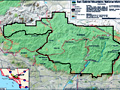
Map: San Gabriel Mtns Nat Monument 2014
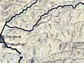
SCV Area Map 2014
FAQ: San Gabriel Mtns Nat Monument 2014
Video: Monument Signing Ceremony 2014
New Signage 2/18/2015
The Stories of Monarch and Pinto
Mining & Ranching in Soledad Canyon & Antelope Valley (Earle 2003)
Black Cat Mine
1967: Forest Turns 75
(Newhall Ranger Station 1923)
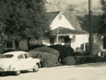
Newhall Ranger Station 1950s
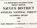
District Map 1953
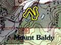
Cultural Resources: Verizon Facility, Mt. Baldy
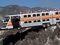
Film: The Big Bus 1976
|


The site owner makes no assertions as to ownership of any original copyrights to digitized images. However, these images are intended for Personal or Research use only. Any other kind of use, including but not limited to commercial or scholarly publication in any medium or format, public exhibition, or use online or in a web site, may be subject to additional restrictions including but not limited to the copyrights held by parties other than the site owner. USERS ARE SOLELY RESPONSIBLE for determining the existence of such rights and for obtaining any permissions and/or paying associated fees necessary for the proposed use.
