
Page 308 - autobluebook1920vol8
P. 308
Route 241 Page 290 Medford-Klamath
St. Avoid left-hand diagonal street 12.9, bearing right onto
double drive. Cross RR 15.8.
16.5 4.0 End of road; turn right and immediately left at barn. Avoid
left-hand road at ranch 19.9. Ascend Siskiyou Mountains
Under RR Over RR
21.4. 27.0. 27.2. Reach summit of
Siskiyou Mountains 29.4. Cross Oregon-California state
line 34.8.
43.1 26.6 Hornbrook, Cal., 4-corners at outskirts (business district 0.1
mile to left). Straight thru.
49.6 6.5 Left-hand road; turn left out of Klamath River Canyon
across iron bridge over Klamath River into Shasta River
Canyon. Cross iron bridges over Shasta River 50.3-52.3-53.5.
Same thorofare becomes Main St.
60.3 10.7 Yreka,* Main & Miner Sts. Straight thru on Main St.
62.1 1.8 Prominent fork; bear left with poles.
69.5 7.4 Prominent 3-corners; bear left with poles.
70.4 0.9 Right-hand road; turn right.
Straight ahead before this turn is Route 174 to Klamath Falls.
70.5 0.1 Grenada, store on right. Straight thru along RR. Thru
4-corners 73.4.
76.8 6.3 Turn left across RR and right at end of road just beyond.
78.2 1.4 Fork; keep right along RR.
78.7 0.5 Right-hand diagonal road; bear right across RR and left
along same.
79.1 0.4 Gazelle, store on left. Straight thru.
85.8 6.7 Left-hand road, just beyond creek, ranch on right; turn left.
86.6 0.8 End of road; turn left. Avoid left-hand road 86.8.
89.7 3.1 Turn right across RR and left at end of road immediately
beyond.
90.3 0.6 Weed, 3-corners at outskirts. Bear right.
HOTELS—Wright's Inn, Highway & Main St.
GARAGES—Sullivan Garage, Highway & Main St.
Left leads to business district, 0.2 mile.
"Yreka, Cal. (pop. 1,150, alt. 2,635 ft.), is sit- in 1850, and so large was the immigration
uated on the Yreka river 85 miles east of that in 1852 the section was formed into a
Crescent City. The name is a corruption of separate county under the name of Sis-ki-you
the Indian word “Ieka,” meaning “whiteness,” with Yreka as county seat. The town was
which was the Indian name for the adjacent first known as Thompson’s Dry Diggings on
snow-crowned Shasta. The settlement of the account of its very rich flat deposits; then,
town was occasioned by the Trinity Gold mine with a slight change in location, it became
excitement of 1849. Governor Joseph Lane of Shasta Butte; but this name causing confu-
Oregon was probably the first to carry on sion with Lower Shasta, the name Yreka was
prospecting operations near the Yreka. He adopted at the time the town was made the
was followed by a party under Rufus Johnson county seat.
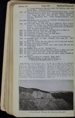
A Good Stretch Through the California Mountains