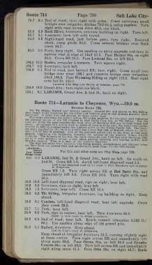
Page 762 - autobluebook1920vol8
P. 762
—
          Route 714       Page 730     Salt Lake City-
          76.7
                                     Cross numerous small
              3.1 End of road; turn right with poles.
                bridges over irrigation ditches 79.2-81.4, using caution.
                                               Turn
                right with road across ditch 83.5, one block.
          83.6  6.9 Rock River, 4-corners, concrete building on right.
                                            Turn left.
          83.7  0.1 4-corners; turn left with travel.
          84.3  0.6 Right-hand  road, just before  gate; turn  right.  Descend
                short, steep grade  84.5.  Cross several bridges over Rock
                creek 84.7.
          85.2  0.9 Fork; keep right.  Use caution on steep upgrade and turn in
                narrow road at edge of bluff 87.6.  Pass Harper Sta. on right
                89.9.  Cross RR 93.3.  Pass Lookout Sta. on left 95.4.
         104.5 19.3 Bosler, irregular 4-corners.  Turn square right.
         104.7  0.2 4-corners; turn left.
         104.8  0.1 End of road, just beyond RR; turn right.  Cross small iron
                bridge over river 106.1 and concrete bridge over irrigation
                ditch 106.8.  Pass Wyoming Siding on right 112.0.
                                            Bear right
                onto 3rd St. 123.0.
                  Laramie City Map and Points of Interest, page 729.
         124.0 19.2 Grand Ave.; turn right one block.
         124.1  0.1 LARAMIE, Grand Ave. & 2nd St., bank on right.
            Route 714—Laramie to Cheyenne, Wyo.—59.0 m.
                        Reverse Route 726.
           Via Tie Siding, Buford and Granite canyon.
                                Graded dirt and gravel to Tie Sidintr
                                        na™rai gravelly
         then rough rocky stretches for ten miles and balance graded and natural gravelly roadroad.
         Summary: 49 miles dirt and gravel; 10 miles rocky road.
               Haverses the gently rolling Wyoming prairies, for the most part following
         the general course of the RR crossed at Red Butte Flag Sta. to Tie Siding
                                              For the
            ten rntles the road ascends the west slope of Sherman Hill and is botlw-oiSh and
                  26 '° and  t £- S Uth of road is to be seen the Am es monument,
              1
                            2
         erected in  c commemorate the highest point on the Union Pacific RR.
                                             The high-
         e«t P  ^ by the route is a mile : and a half this side of Buford, where an eleva-
                 i
         uon of 8,13- feet
         tion of s TO fl? is attained.  One of the greatest gravel pits in the west
             SU     bab sting material      is that near
           r                  for several of the western Union
                                              Pacific
         mvisions  The bal nc  f ^ way the route descends over 2,000 feet over Sherman Hill
                     tbe
              ThJ^nnce e
                  ^
         all of  it very gradual, except a few short pitches entering and leaving gullies nearnear
                   1
         Gr ™  te canyon '  This  is a P art of the Lincoln highway.  B *
             «
             fil S
         ti,JpL D!ii en mlles from Laramie was being graded, straightened and widened when
         the Blue Book car passed thru and should be in good shape for the 1920 season.
         ,—M LEAG E
           I
              N
          Total Be^Mn*  For this and Other exits see City Map, page 729.
         Mileage Points
          0.0  0.0 LARAMIE, 2nd St. & Grand Ave., bank on left.
                                           Go south on
               2nd St.  Cross RR 1.0.
                            Avoid left-hand diagonal road 1.1.
                  p  eft~hand diagonal road at 1.1 leads to Fish Hatcherv and is option
                  to Cheyenne.
                                              •
               Cross RR 1.2.  Turn right across RR at Red Butte Sta. and
               immediately left 9.3.  Cross RR 10.0.  Turn right with road
               16.1.
         16.3 16.3 Left-hand diagonal road, sign on right; bear left.
         16.8  0.5 3-corners, sign on right; bear left.
         18.3  1.5 3-corners; bear left.  Cross RR 18.4.
         18.5  0.2 Tie Siding, irregular 4-corners, log building on right.
                                              Keep
               ahead.
         18.6  0.1 Caution, left-hand diagonal road; bear left upgrade.
                                              Cross
               Dale creek 23.5.
         25.7  7.1 Fork; keep  left.
         25.9  0.2 Fork, sign in center; bear left.  Thru 4-corners 26.0.
                  Right  14 mile leads to Ames monument.
         26.2  0.3 End of road; bear left.
                             Reach summit (elevation 8,132 ft.)
               30.1.  Use caution along edge of old gravel pits.
         31.6  5.4 Buford, 4-corners. Keep ahead.
                  Left is Lion’s trail to Cheyenne.
               Keep ahead at irregular 4-corners 31.7, curving slightly right
               at fence corner.
                         Turn right across RR and immediately left
               along same 36.6.  Pass Ozone Sta. on  left 36.8 and Granite
               Canyon Sta. on left 40.0. Turn left across RR and immediately
               right along same 41.1.  Pass Otto Sta. on right 44.7; Borie

