
Page 654 - sandcanyonplaza_deir0317
P. 654
4. Environmental Impact Analysis 4.19 - Traffic and Circulation
The SCVCTM is regularly updated as specific development projects are proposed. Pending,
recorded, and approved projects are incorporated into the Long-Range Buildout/Cumulative
database. A list of the known cumulative projects that have been included within the Year 2030
database is provided in Table 4.19-25. Interpolated growth for areas in which the One Valley One
Vision (OVOV) plan anticipates future development is not included, although such growth is
accounted for in the impacts analysis. Figure 4.19-4 shows the general location of the projects listed
in Table 4.19-25.
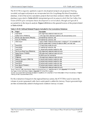
Table 4.19-25 Defined Related Projects Included in the Cumulative Database
No. Project Description
1 Tract 46018 201 single-family detached residential units
2 Skyline Ranch (TR060922) 1,260 single-family detached residential units and elementary school
3 Beneda Lane Apartments (TR62252) 24 multi-family residential units
4 Sierra 55 (TR60536) 55 multi-family residential units
5 Vista Canyon Transit-oriented mixed-use development consisting of 1,100 residential units,
950,000 square feet of commercial retail and office, and hotel uses
6 Tract 46353 110 multi-family residential units
7 Tract 066202 31 multi-family residential units
8 Tract 52790 41 single-family detached residential units
9 Tick Canyon/Park Place (TR060259) 492 single-family detached residential units
10 Spring Canyon (TR48086) 499 single-family detached residential units
11 PM068498 60,496 square feet commercial
12 TTM63022 109 single-family detached residential units
13 Robinson Annexation (TR65159) 40 single-family detached residential units
14 Tract 060359 34 single-family detached residential units
15 Tract 54372 26 single-family detached residential units
16 Brook Street (TTM68601) 35 single-family detached residential units
17 Tract 52990 179 single-family detached residential units
Source: Table 2-8, Traffic Impact Analysis, Stantec Consulting Services, Inc., dated December 21, 2016 (Appendix 11-1 to this EIR)
See Figure 2-8 in the Traffic Impact Analysis in Appendix 11-1 of this EIR for locations.
Sources: City of Santa Clarita Community Development Department, LA County Dept. of Public Works (March 2014); LA County Dept. of Regional
Planning GIS-NET3 (accessed March 2014).
For the evaluation of impacts to the regional freeway system, the SCVCTM is used to derive the
volume of project generated traffic that is anticipated to utilize the freeway. Project-generated trips
are then incrementally added to background condition freeway volumes.
Tebo Environmental Consulting, Inc. Sand Canyon Plaza Mixed-Use Project Draft EIR
March 2017 4.19-37