|
|
By Gerald A. Eddy

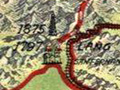
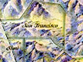
Click image to enlarge Historical map of California by Gerald A. Eddy, originally titled "Important Historical Events Which Have Made Los Angeles' Growth Possible," 1929. Be sure to click & enlarge the map. According to contributor Jason Brice, Eddy worked in the art department of the Los Angeles Examiner newspaper. Entries for the Santa Clarita Valley and environs include petroleum development at Pico Canyon, which it identifies as 1875; the establishment of Mission San Fernando in 1797; the "first train from north" through the Tehachapis to Lang in 1876; and the "first water to Los Angeles" through the L.A. Aqueduct in November 1913. The map recognizes Sutter's Mill but doesn't acknowledge the earlier gold discoveries in the SCV.
JB2901: 19200 dpi jpeg from smaller jpeg in Library of Congress. |
Yesterdays of Los Angeles ~1927
La Reina (L.A. Regional History) 1929
Historical Events 1929
Land Grants, L.A. County (1949)
Pueblo de Los Angeles (2005)
|
The site owner makes no assertions as to ownership of any original copyrights to digitized images. However, these images are intended for Personal or Research use only. Any other kind of use, including but not limited to commercial or scholarly publication in any medium or format, public exhibition, or use online or in a web site, may be subject to additional restrictions including but not limited to the copyrights held by parties other than the site owner. USERS ARE SOLELY RESPONSIBLE for determining the existence of such rights and for obtaining any permissions and/or paying associated fees necessary for the proposed use.
