|
|
Ex-San Francisco Public Utilities Commission Archives
Click image to enlarge
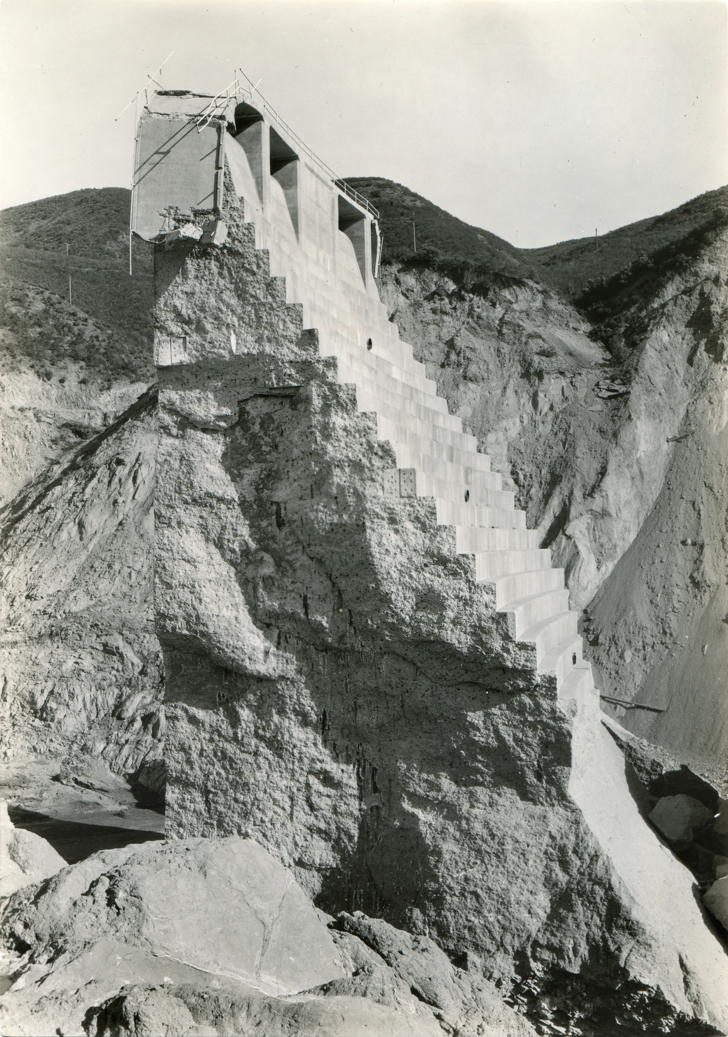
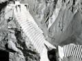
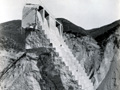
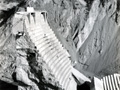
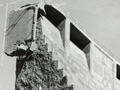
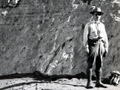
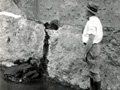
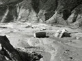
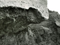
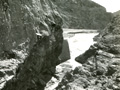
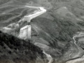
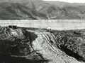
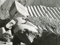
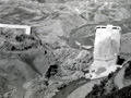
A section of the St. Francis Dam, known as the "tombstone," remained standing after the dam broke on the night of March 12, 1928. To the consternation and embarrassment of Los Angeles water officials, it became a tourist attraction. In May 1929, more than a year later, it was dynamited into oblivion after an adventurous young man fell from the top of it and died. St. Francis Dam engineering expert J. David Rogers writes: This is a nice image showing the steps of the downstream face on Block 1, along with three of the four 30-inch diameter outlet pipes. The lowest one shown here was third from the top, and exited the dam at elevation 1685 feet (the spillway crest was at 1835 ft). Just below 1685 ft, the downstream stepped were cleaved off by the sliding of Blocks 5, 6, and 7 across the dam's downstream face, from the left abutment (in distance) toward the right abutment (where the photographer was standing), being carried on a massive landslide comprised of Pelona Schist. The jagged face nature of the exposed side of Block 1 was more or less along a pre-existing tension crack formed by contraction of the dam's mass concrete, long before the failure occurred. This was ascribable to the curing of the concrete, and instead of grouting these cracks from the upstream face forward (towards the downstream face), Mulholland had ordered the tension cracks to be sealed with Oakum at the downstream face, which I have come to believe was one of the most significant "fatal flaws" in precipitating the dam's demise.
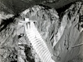
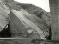
Photograph shot on or shorly after March 13, 1928. The dam collapsed at 23:57:30 on March 12 and it took about 72 minutes for the 12.5-billion-gallon reservoir to empty (Outland 1977). About the image: One of seventeen 5x7-inch glossy photographs found in a box in the Photography section of the San Francisco Public Utilities Commission's Engineering Archives in 2013.[1] There was no record of the origin of the photographs and no writing on the back to identify subjects or dates. Current SFPUC staff members did not know the reason for their inclusion in the archive. Ownership transferred via email communications (on file) from SFPUC to SCVTV-SCVHistory.com. Prints received July 11, 2014; subsequently transferred to the Santa Clarita Valley Historical Society.
1. A hand-written notation by current San Francisco PUC staff indicates the images were emailed Aug. 8, 2013, to someone who identified them as the St. Francis Dam. SFPUC staff alerted us to their existence in the Spring of 2014.
Construction on the 600-foot-long, 185-foot-high St. Francis Dam started in August 1924. With a 12.5-billion-gallon capacity, the reservoir began to fill with water on March 1, 1926. It was completed two months later. At 11:57:30 p.m. on March 12, 1928, the dam failed, sending a 180-foot-high wall of water crashing down San Francisquito Canyon. An estimated 411 people lay dead by the time the floodwaters reached the Pacific Ocean south of Ventura 5½ hours later. It was the second-worst disaster in California history, after the great San Francisco earthquake and fire of 1906, in terms of lives lost — and America's worst civil engineering failure of the 20th Century.
LW2642j: 19200 dpi jpeg from original 5x7-inch glossy print. |
|
The site owner makes no assertions as to ownership of any original copyrights to digitized images. However, these images are intended for Personal or Research use only. Any other kind of use, including but not limited to commercial or scholarly publication in any medium or format, public exhibition, or use online or in a web site, may be subject to additional restrictions including but not limited to the copyrights held by parties other than the site owner. USERS ARE SOLELY RESPONSIBLE for determining the existence of such rights and for obtaining any permissions and/or paying associated fees necessary for the proposed use.
