|
|
U.S. Army
|
Historical Overview of Nike Missile System U.S. Army Toxic and Hazardous Materials Agency December 1984
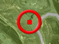
The Santa Clarita Valley was home to two Cold War-era Nike bases. Each involved either two or three physical locations. The IFC, or Integrated Fire Control site — what we think of as a Nike base — housed the radar system that acquired and tracked the targets and guided the missiles. The actual missiles were located at a separate launch site. • Los Pinetos-Newhall (LA-94): IFC in the Angeles National Forest off of Sand Canyon Road at Bear Divide; launch site less than a mile away. In use by the Army from 1955 to November 1968, when the Pentagon realigned its missile defense operations. Control of the double battery at Los Pinetos transfered to NORAD. • Magic Mountain-Lang (LA-98): IFC in the Angeles National Forest on top of Magic Mountain (not the amusement park); launch site near a cement plant by the former Lang Station in Soledad Canyon. In use from 1955 to December 1968 (missile battery closed in 1963). Other nearby Nike bases were located at Oat Mountain above Chatsworth and Mt. Gleason in Palmdale. The Nike program, named for the Greek goddess of victory (not an acronym), was developed out of Bell Labs in 1945. The first missile was successfully tested in 1951, making it the world's first widely deployed, defensive surface-to-air missile system. The first type of missile, the Nike Ajax, had a 25-mile range and was armed with three high-explosive, fragmentation-type warheads. At many locations the Ajax would be replaced by the Hercules, which had an 80-mile range and was capable of carrying a nuclear warhead. The Magic Mountain-Lang base was only an Ajax site. After it closed, the IFC became a microwave relay station and the launch site became part of a gravel quarry. Los Pinetos converted to Hercules. After it closed, the IFC became Los Angeles County Fire Camp No. 9. Its double-battery launch area on Bear Divide Road remained intact. The area became a U.S. Forest Service facility, while the upgraded missile system is controlled by NORAD (North American Aerospace Defense Command) in Colorado Springs, Colo.
|
Nike Missile System: Historical Overview Los Pinetos-Newhall Site History (HAER) 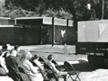
Army Housing 1959
|
The site owner makes no assertions as to ownership of any original copyrights to digitized images. However, these images are intended for Personal or Research use only. Any other kind of use, including but not limited to commercial or scholarly publication in any medium or format, public exhibition, or use online or in a web site, may be subject to additional restrictions including but not limited to the copyrights held by parties other than the site owner. USERS ARE SOLELY RESPONSIBLE for determining the existence of such rights and for obtaining any permissions and/or paying associated fees necessary for the proposed use.
