|
|
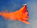
Powerhouse Fire
Click image to enlarge
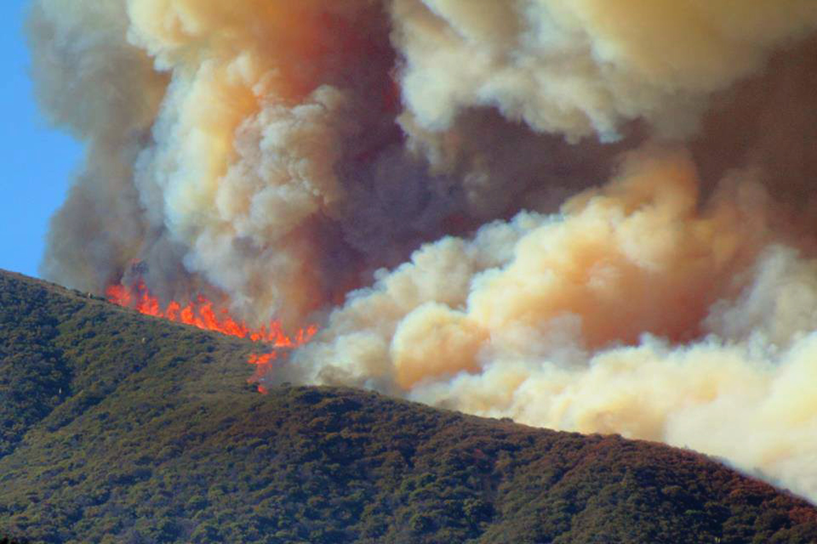
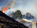
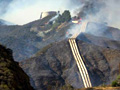
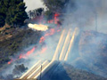
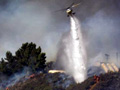
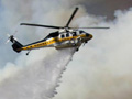
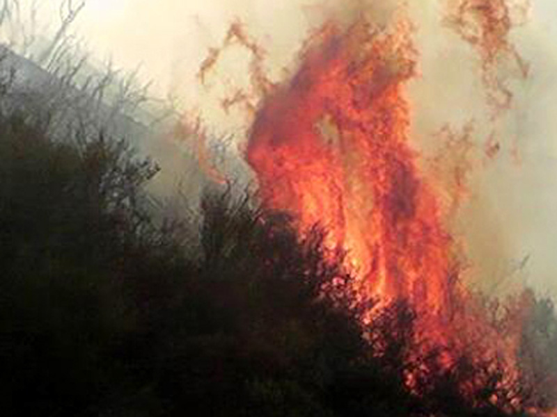
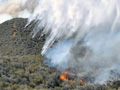
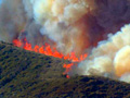
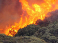
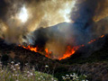
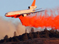
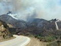
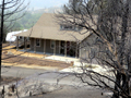
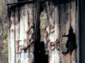
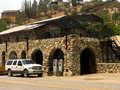
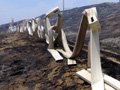
May 30, 2013 — Although much of San Francisquito Canyon burned in 2002 and the mountains around Green Valley burned in 2008, the Powerhouse Fire managed to find areas of dense, dry chaparral that hadn't burned since the 1920s. Photo by Matthew Moore, submitted to SCVTV via Facebook. The Powerhouse Fire broke out Thursday afternoon, May 30, 2013, near Power House 1 (thus the name) in San Francisquito Canyon and quickly spread north. By the time the smoke cleared two weeks later, 30,274 acres (47.3 square miles) of brush were blackened, 30 homes were declared total losses, and another 28 outbuildings were destroyed. The Hughes and Elizabeth Lake communities bore the brunt of the devastation, which extended as far north as the Antelope Acres subdivision in south Lancaster. In Lake Hughes, four or five single-family homes burned completely to the ground on the evening of Saturday, June 1 — primarily on the south side of Newview Drive — when high winds, low humidity and dry fuels conspired for "perfect" fire conditions. Some of the old-growth chaparral hadn't burned since the 1920s. In all, nine firefighters were injured, either from falls, cuts and bruises, dehydration, heat exposure or poison oak (its ash is still poisonous). Some of them returned to the fire lines. The Federal Emergency Manangement Agency (FEMA) agreed to pay up to 75 percent of the cost of fighting the fire, preliminarily pegged at $23.4 million. The apparent point of origin was a hillside in the Angeles National Forest directly above the Los Angeles Department of Water and Power's northernmost of two power plants in the canyon, 11.5 miles past Copper Hill Drive in Santa Clarita and just beyond the former reservoir of the ill-fated St. Francis Dam. At 3:28 p.m. on May 30, "(t)he fire was first observed by a power plant station operator burning just north of the Power Plant 1 near San Francisquito Canyon Road," an LADWP statement said. The USDA Forest Service was first on scene and initially called off L.A. County firefighters who were dispatched to assist. When the flames jumped the road and it was apparent that containment was nowhere in sight, L.A. County Fire was called back, L.A. County Sheriff's units provided support, and the Forest Service took command of the incident. CAL FIRE, the state fire department, wasn't far behind. By evening the fire had consumed 1,000 acres and threatened Green Valley, whose residents were evacuated to a Red Cross center at Marie Kerr Park in Palmdale. Large animals went to the Antelope Valley Fairgrounds. Ultimately the fire didn't reach Green Valley; instead, the southern flank continued to burn near the power plant for days while the northern flank rushed toward Lake Hughes. First responders rounded up missing hikers; by Saturday evening the lake communities were evacuated and firefighters from multiple agencies were arriving to assist. The coming days would see 2,185 firefighters engaged in fire protection, mop-up, overhaul and structure protection. Although structures were lost, countless others made narrow escapes, thanks both to firefighters and to a number of residents who refused to evacuate. Such was the case of the Lakes Community Center, whose resident manager stayed behind. Many feared the center was lost; it wasn't. Nor was the HELUS elementary school (Hughes-Elizabeth Lakes Union School District), surrounded on three sides by fire. Papas Country Store made it through, as did the historic 1929 Rock Inn, which reopened at 4 p.m. the next day and became a de-facto information center. The Painted Turtle — a camp for chronically ill children, founded by Paul Newman at the site of the former Munz Lakes Resort — brushed with death as the flames licked several buildings. All major structures were saved (a barn and two sheds burned), but the grounds were completely destroyed and the buildings sustained heavy smoke damage. Officials were forced to call off the 2013 season and embark on "an extensive process of landscape cleanup and hydro-seeding, cleaning of all buildings and ventilation systems, and an ozone cleaning process of every building to ensure that The Painted Turtle facility meets the high level of safety that is the trademark of our program." Evacuees who had homes to return to in Lake Hughes and Lake Elizabeth faced more challenges. The L.A. County Department of Public Health advised them to boil their drinking water because the fire might have damaged water pipes and towers, and because downed power lines had forced officials to shut off power to the region during the fire, possibly reducing well pressure to a point where Total coliform and E-coli bacteria could spawn. Those who couldn't boil water were told to use ¼ teaspoon of bleach per gallon of clear water, or ½ teaspoon if it was cloudy. The stubborn fire made its last gasps for several more days on Sawtooth Mountain and the nearby Cottonwood Campground on Lake Hughes Road, southwest of town. The USDA Forest Service transfered incident command to L.A. County Fire for mop-up on June 10, 2013.
LW2399f: 9600 dpi jpeg from digital image by Matthew Moore. |
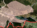
Perimeter Map
Day 1 x10
Day 2 x8
Day 3 x4
Days 4-5 x5
San Francisquito x8
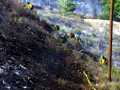
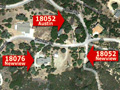
Lost Homes x12
Saved Homes x12
Painted Turtle x20
Wetlands & Golf x6
More Survivors x6
Miscellany x11
Misc. x3
|


The site owner makes no assertions as to ownership of any original copyrights to digitized images. However, these images are intended for Personal or Research use only. Any other kind of use, including but not limited to commercial or scholarly publication in any medium or format, public exhibition, or use online or in a web site, may be subject to additional restrictions including but not limited to the copyrights held by parties other than the site owner. USERS ARE SOLELY RESPONSIBLE for determining the existence of such rights and for obtaining any permissions and/or paying associated fees necessary for the proposed use.
