|
|
Acton | Great Flood of 1938
Click image to enlarge
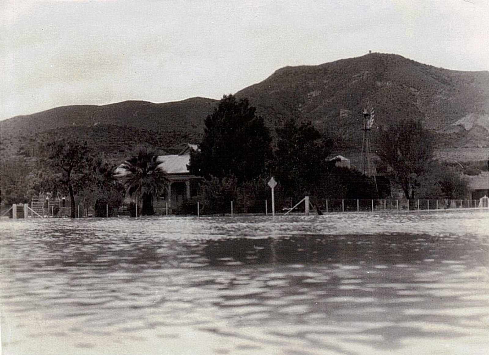
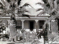
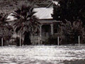
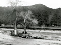
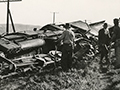
Flooding at the intersection of Crown Valley Road and Cory Avenue. Most likely the Great Flood of March 2, 1938. The view is to the southwest toward the former R.E. Nickel home — the Freese home, in 1938 — at what is now 31823 Crown Valley (SW corner of Crown Valley and Cory). The photographer is standing at the northeast corner. One way to estimate the date is to consider the size of the two palm trees in front of the house. The were knee-high to a tadpole when Nickel planted them in the 1890s. Compare their height in the 2014 photograph. In the black-and-white photo they're somewhere in between. Another way to identify this image is by comparing it to a photograph on page 301 of Meryl Adams' 1988 book, "Heritage Happenings." The photograph in the book shows the Acton Hotel in the Great Flood of 1938. Except for the camera being pointed to the right (north) of the image above, the conditions — the weather, the level of water in the road — are identical. According to Meryl Adams (1988:65), Richard E. Nickel — the so-called "Father of Acton" and the town's second permanent resident, having married the daughter of its first — started construction on this house for his young family in 1895 and completed it in 1896. However, this might be a bit late. According to L.A. County Assessor records, the 1,216-square-foot, 3-plus-1 home has a construction date of 1891. Nickel rented out the home when he moved to the San Francisco area at the beginning of the 20th Century. At the time this photograph was shot, the old Nickel place was the Freese residence. According to Adams, Albert W. Freese arrived in Acton in 1903 and served as a Southern Pacific Railroad section foreman for 32 years. In 1935 — apparently upon his retirement — Albert and his wife Annie bought the Nickel home. Annie Freese died just five years later in 1940, followed by Albert in 1958. "Mr. Freese put in the 18-inch retainer wall for flood protection, and also put the white stucco on the original house," Adams writes (1988:391). We're not sure if there's a retaining wall in this photograph, but if there isn't, you might guess what prompted him to build one. (It can be seen in the 2014 color photograph.) "The home was noted for the roses maintained by Mr. Freese," Adams adds. About the contributor. Don Milburn received the original photograph from his mother, Marie Milburn. Marie and her husband Jack Milburn had come to Acton in the 1940s and lived at the John LaBadie ranch on Hubbard Road. Don remembers that "Grampa John" LaBadie's[1] morning routine was to "hang the outgoing mail bag onto mast by the railroad tracks. The Southern Pacific train would toss the incoming Acton mail bag onto the ground and a mechanical arm would grab the outgoing mail bag and haul it into the train. It was great fun for us kids to chase down the mailbag for Grampa John and drag it to his car for him." In 1950 the Milburns moved to a house at Crown Valley and Soledad Canyon Road. Says Don: "Dad worked for L.A. Country at Acton Rehab center in the mornings and remodeled houses in the afternoons and evenings. Mom worked at the Acton school for many years and then worked at Acton Rehab for a long time. Both mom and dad retired from Acton Rehab."
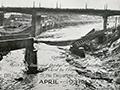
1. See Meryl Adams 1988:395. About the Great Flood of 1938. Surpassing the St. Francis Flood of 1928 in scope — if not in deaths — the Great Flood (aka Los Angeles Flood) of 1938 hit the greater Los Angeles area hardest overnight on March 1-2. By the time the water receded, 5,601 buildings had been destroyed and 113 to 115 Southland residents were killed. Considered a 50-year flood, it started Feb. 27, 1938, when a storm system moved in from the Pacific Ocean and hit the San Gabriel Mountains. The region was soaked with continual rainfall that caused only routine flooding until a second storm came on the heels of the first. Driven by gale-force winds, it hit March 1 at about 8:45 p.m., dumping 10 inches of rain in the lowlands and at least 32 inches in the mountains. Almost every vacation resort in the San Gabriels washed away; most were never rebuilt (see Robinson 1977). The Santa Clarita Valley wasn't spared. The Santa Clara River overflowed. Roads and bridges were wiped out and ranch buildings situated along the riverbank floated away. (Note to current residents: The Santa Clara River might look dry most of the year, but watch out when it rains. It's prone to flash flooding. Stay away.) As hard as Los Angeles County got hit, Orange and Riverside counties actually sustained more damage because they lacked the kind of flood-control system L.A. had with the Santa Ana River system. (The Santa Ana, Los Angeles and San Gabriel rivers overflowed, too.) But Los Angeles was far more populated; Orange and Riverside counties were largely agricultural. In response to the 1938 flood, Congress passed the Flood Control Act of 1941, which authorized the U.S. Army Corps of Engineers to channelize the Los Angeles River and parts of the Santa Ana. And that's why the L.A. River is a concrete flood-control channel instead of the wild-flowing river it once was. — Leon Worden 2013
DO3801: 19200 dpi jpeg from smaller jpeg | Online image only. |
Envelope Postmarked 1894 by R.E. Nickel
Rudy Nickel Marriage License 1926
Pre-1938
Flood of 1938
Calif. Highways 4/1938
Calif. Highway Patrolman 4/1938
Panhorst: Highways 1938
1938: Pollack Story
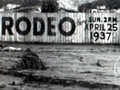
Saugus Rodeo (Speedway) 1938
Acton 1938?
Mentryville 1938?
Santa Clara River
Nickel-Freese Home, Acton
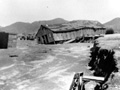
Train Derailed
3/25/1938
Army Corps to Channelize River 8/12/1968
|


The site owner makes no assertions as to ownership of any original copyrights to digitized images. However, these images are intended for Personal or Research use only. Any other kind of use, including but not limited to commercial or scholarly publication in any medium or format, public exhibition, or use online or in a web site, may be subject to additional restrictions including but not limited to the copyrights held by parties other than the site owner. USERS ARE SOLELY RESPONSIBLE for determining the existence of such rights and for obtaining any permissions and/or paying associated fees necessary for the proposed use.
