
Page 10 - ssmtmp2_initialstudy20171102
P. 10
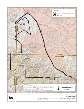
LEGEND

                                                                                    USGS 7.5-Minute Quadrangle Index
                                                                                    Study Area


                               Low Point
                               Elev. 946 Ft.
                        VAL VERDE  NEWHALL


                                             Phase II.a


                                                                                    NEWHALL
                                                                                 OAT MOUNTAIN
                                             Sand Rock Peak
                                              Elev. 2,511 Ft.


                             High Point
                            Elev. 3,430 Ft.


                       SIMI VALLEY EAST  OAT MOUNTAIN


                                   SOURCES:
                                   Basemap: ESRI USGS Topo Map.                            0     0.5    1
                                   Elevation Points: Provided by John Diaz, County of Los Angeles Dept. of
                                   Parks and Recreation. DEM data created by Infotech Enterprises, LLP - QC  Miles
                                   by Dewberry, project managed LAR-IAC.
                                   Quadrangle Index: US Geological Survey 2010.                1:70,000
                                   Study Area: LA County Dept of Parks and Recreation (LACO-DPR) 2017.
                                                                  Q:\Projects\1020\1020-097\ArcProjects\MND\Sept2017_Draft_MND\Project Description\Fig1.4-3_TopoMap_IIa.mxd

                                                                                                 FIGURE 1.4-3a
                                                       Topographic Map with USGS 7.5 Minute Quadrangle Index