|
|
Soledad & Whites | Canyon Country
SEE ALSO:
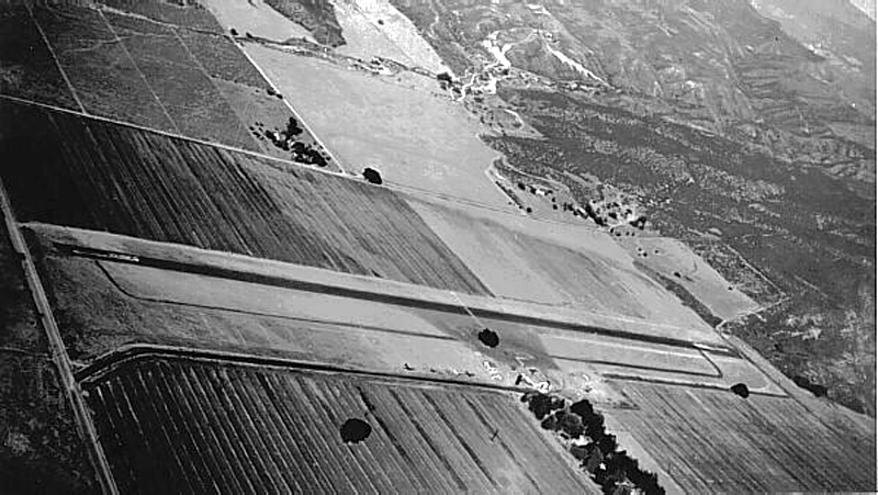
Helm and Earle Schmidt opened an airport in 1946 on the 1,800-acre 6-S Ranch, which had previously been owned by the grandson and namesake of the pioneer Los Angeles 20-Mule team freighter, Remi Nadeau. It was known as Nadeau Deer Farm and was, for years, one of the famous sights of northern Los Angeles county. The airfield sat to the northwest of the modern-day intersection of Soledad Canyon and Whites Canyon Roads. Following Helm Schmidt's death in 1960, the acreage was sold and developed into the North Oaks tract, which began construction in 1961. It was the Santa Clarita Valley's second housing tract — the first being the 15-home "Rancho Santa Clarita" subdivision that the William Bonelli family built in Seco (Dry) Canyon in 1947. By 1963, the North Oaks area, which had previously been considered a part of Saugus, was starting to achieve its own identity as "Canyon Country." The name became official in 1968 when the Canyon Country Post Office opened near Solemint Junction (the intersection of Soledad Canyon Road and Sierra Highway).
6-S Ranch Airpark featured in "The Beast of Yucca Flats" "Plan 9 from Outer Space," starring Eternal Valley Cemetery resident Tor Johnson, was voted the worst movie of all time. Sorry, but we’ve got it beat with this 1961 Tor Johnson feature, "The Beast of Yucca Flats," which actually IS the worst movie of all time. Bonus: It was filmed almost entirely in the Santa Clarita Valley, particularly Canyon Country, when Canyon Country was little more than sagebrush, rattlesnakes, and the 6-S Ranch Airpark. History of SCV airstrips by Larry Westin: The Saugus Airport, later known as the Newhall Airport, was an intermediate field along the airway — "intermediate" meaning it wasn't a scheduled airline stop, rather an airport used if an airliner needed to divert from a planned destination. For instance, fog in the San Fernando Valley might require a landing farther north at a slightly higher elevation that wasn't shrouded in fog — such as Saugus. At first, U.S. airways were lighted; that is, beacons on top of towers were used for airliners of the 1920s and 1930s to navigate at night — but not in bad weather. Saugus was beacon 3A along the lighted airway from Los Angeles to San Francisco. Its runway was 2,470 feet long, 600 feet wide. The 1930 diagram shows its approximate position relative to San Fernando Road (aka Railroad Avenue/Bouquet Canyon Road). Sometime in the 1930s, four-course radio beacons were set up for aircraft navigation. This was a leap ahead of the light beacons and lighted airways, as these radio ranges were all-weather. A radio beacon was established and identified as the "Newhall" beacon, operating on 209 KHz, with the Morse code identifier of NH. These early radio beacons were limited to four courses. The Newhall beacon was initially part of the Amber 1 airway; later it also was part of the Green 4 airway. A 1943 map shows the airfield named "Newhall" (not Saugus) at an elevation of 1190 feet above sea level. A 1946 aeronautical chart shows the airport as Newhall, elevation of 1207 feet, with a 4,000-foot-long runway. It still has the 3A lighted airway beacon, 4-course radio beacon 209 KHz, identifier NH. A 1951 aeronautical chart shows the airport as Newhall, elevation of 1207 feet, with a 4,000-foot-long runway. The lighted beacon is no longer shown; the radio beacon is 209 KHz, new identifier EHA, 4 courses. Also in 1951, a new airport is shown: the 6-S Ranch, elevation 1350 feet, with a 2,600-foot-long runway, located about where Whites Canyon Road in Canyon Country is today. A 1960 aeronautical chart no longer shows Saugus or Newhall having an airport. The radio beacon 4-course range at 209 KHz, identifier EHA, now makes up the southwest end of Green 4 airway. The 6-S Ranch airport is still shown, elevation 1349 feet, runway 2,500 feet long. A 1962 aeronautical chart no longer shows any airport in the Saugus/Newhall/Canyon Country area. (Established in 1946, the 6-S Ranch Air Park closed in 1960, upon the death of its owner. It became the North Oaks housing tract.) In 1962 the radio beacon 4-course range was still operational on 209 KHz, identifier EHA. While in 1962 many 4-course radio ranges still existed, the "colored" airways were no longer shown. Most airways switched to the "Victor" airways using VHF omni-directional (360-course) radio navigation stations. After this time, aeronautical facilities in the Santa Clarita Valley no longer existed.
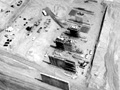
AP2406: (Needs rescan). |
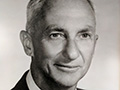
About Earl Schmidt
Built Airplane 1928
6-S Ranch Airpark, Shell Progress 1947
6-S Ranch Airpark ~1950s
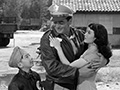
6-S Ranch Airpark in "China Doll" (1958)
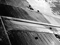
6-S Ranch Airpark in "The Beast of Yucca Flats" (1961)
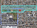
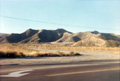
Location of 6-S Ranch Airpark
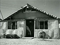
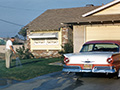
Helm Schmidt Home in Newhall 1961
Looking South 1968
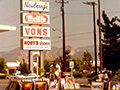
Newberry's, Alpha Beta ~1970s
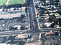
Aerial: Whites 1979
Whites Canyon Bridge Construction 1988
|
The site owner makes no assertions as to ownership of any original copyrights to digitized images. However, these images are intended for Personal or Research use only. Any other kind of use, including but not limited to commercial or scholarly publication in any medium or format, public exhibition, or use online or in a web site, may be subject to additional restrictions including but not limited to the copyrights held by parties other than the site owner. USERS ARE SOLELY RESPONSIBLE for determining the existence of such rights and for obtaining any permissions and/or paying associated fees necessary for the proposed use.
