March 23, 2013 — Silver King Mine in Texas Canyon.
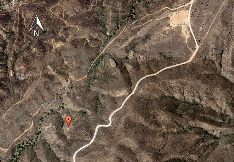
To get there, go to the Rowher Flats OHV parking lot. From there, take the Rowher Truck Trail (Forest Route 5N14) about 1 mile to the southwest.
Roughly half way, you'll pass by the distinctive Table Rock feature. Keep going. You should see trail markers that say Silver King. The tunnel openings are on the left (southeast).
There are two tunnel openings. Both are closed off with metal grates. As of 2013, the tunnel entrance on the right (west) has been stablized with a cylindrical, corrugated aluminum
tube that wasn't there a year earlier.
From the State Mining Bureau quarterly report of January 1927:
Silver King Mine. (Lead-Silver.) It is located in Texas Canyon,
12 miles northeast of Saugus, a station on the Southern Pacific Railroad. Holdings comprise 18 claims. Elevation 2350 feet. Owner,
W.H. Cruzan, Newhall, California.
A vein of quartz 2 feet wide strikes east and dips 53° north. The
quartz is mineralized with galena and said to carry 10 to 30 oz. in silver
per ton.
Workings consist of glory hole and two tunnels, the upper tunnel
250 feet in length. From this level a raise connects with glory hole.
At a lower elevation, a tunnel has been driven 100 feet east parallel
to the vein in the footwall. One man is employed.
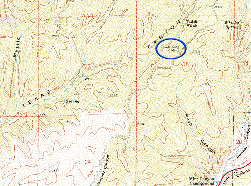
The mine is shown at the bottom left of the USGS Green Valley quadrant (below).

Portion (lower left corner) of USGS Green Valley topographical map. Click map to enlarge.

The Rowher Flats OHV parking lot is at upper right. The icon marks the mine. Click map to enlarge.