CCC Camp
Bear Canyon-Saugus (Iron Canyon)
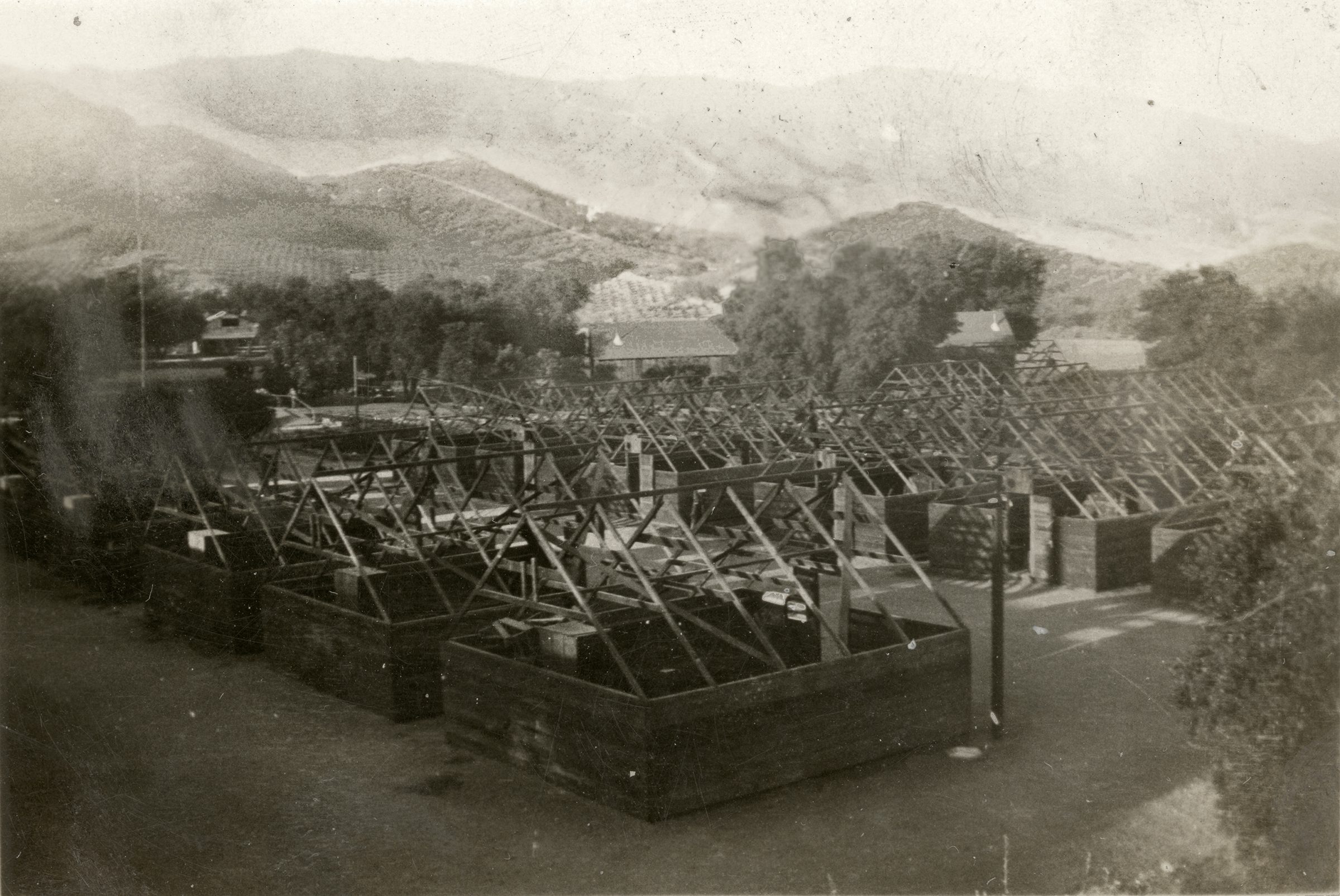
Click image to enlarge.
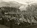
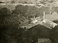
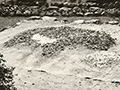
Then (1936) & Now (2020).
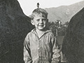
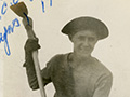
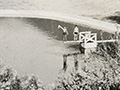
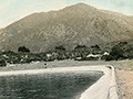
About the 1936 Photo. Civilian Conservation Corps (CCC) Camp Bear Canyon/Saugus. Image digitally enhanced to bring out the mountains. The view appears to be to the south or southwest, with property owner Michael Bello's rows of grapevines showing in the distance. Handwriting on back of photograph reads: "The last day in Bear Canyon / Saugus, California." This would refer to the photographer's last day at camp, not the last day of the camp's existence. This is probably 1936, since we know the photographer was there in 1935 and 1936. The camp closed in the spring of 1939.
One in a set of eight tiny, 2x3-inch personal photographs (2.5x3.5 inches, including margins) from an unknown source — apparently a man who was an enrollee with CCC Company 1647 at "Bear Canyon, Saugus" in 1935-36 — and purchased from a third-party vendor who acquired them at a collectibles show in Portland. There is some indication the CCC enrollee traveled between Saugus and Idaho. The CCC Bear Canyon/Saugus camp was located east of Sand Canyon Road in Iron Canyon, at the present-day intersection (east side) of Iron Canyon Road and Knochaven Street. Camp crews evidently worked on a 3-month rotation; another CCC company, No. 551, was assigned to the Bear Canyon location in 1933-34. Read more about the CCC Bear Canyon/Saugus camp location here.
About the "Then & Now" Photos. Jim McClain writes (May 20, 2020): My name is Jim McClain. A friend recently sent me your story, "Ballfield Named For CCC Worker Killed While Battling SCV Brush Fire." It was an amazing story and was even more incredible to me when I learned the location of the CCC camp was on the property I currently own. I live at 15640 Knochaven St., which is on the corner of Knochaven and Iron Canyon. I was really knocked out when I saw the additional photos that someone salvaged for 1936 of the camp. I believe the photo of the cabins being taken down was taken from the hill behind my house looking south across Iron Canyon toward what is today Sand Canyon and the McMillan Ranch development. In fact, I went up this morning and took a photo standing it was was pretty close to the exact spot the original was taken. I'm attaching the current photo. I also overlaid the old photo on top of the new on and the mountains in the background matched perfectly. Of course, all the trees obscure the lower foreground hills where the vineyards were. I'm attaching another overlay photo, removing some of the trees. I stretched the original photo a bit to fit since it was 2x3 and the perspectives were a little off. It appears the camp was located in the yard behind my house and where my house actually is and then on out into my neighbor's yard and into my field next to the house. In the "current" photo, the house you see belongs to my neighbor who lives on Iron Canyon [Road]. Her cross street is Knochaven. My son was fascinated with the story, as he is a big history buff, and it is even more incredible when stories like this one make the history come alive. We have found a few interesting thing on the property in the 25-plus years we have lived here and now can put some of those items into a historical context. Thank and enjoy the photos. Feel free to post them if you like.
About the Civilian Conservation Corps.
With unemployment at 25 percent in the fourth year of the Great Depression, Congress granted President Franklin D. Roosevelt emergency powers less than a month after he took office. Days later, on April 5, 1933, FDR created the Civilian Conservation Corps by executive order. Considered one of the more popular New Deal programs, its goal was to employ young men to plant trees and arrest the destruction of America's natural resources. By late 1935, more than 2,650 camps were operating in all 48 U.S. states including more than 150 in California. They operated at the direction of different federal and state agencies. Locally, camps were established under U.S. Forest Service control in Acton (which became Acton Rehab), Agua Dulce (north of town in the Sierra Pelona foothills), Oak Flat (Castaic area), Elizabeth Canyon and Bouquet Canyon (per Jerry Reynolds), Bear Canyon/Saugus (Iron Canyon), Wildwood Canyon (near Newhall-Happy Valley), Mt. Pinos and maybe elsewhere. Most unemployed youth were in the east, while most of the projects were in the west. They earned $30 per month and sent $25 of it home to their families. Nationally from 1933-1942, more than half a million enrollees planted more than 3 billion trees, erected 3,470 fire towers, built 97,000 miles of fire roads, fought fires and floods, performed erosion control, and created parks — including, in California: Big Basin, Mt. Diablo, Mt. Tamalpais, Pfeiffer Big Sur, Cuyamaca Rancho and more. The CCC also rebuilt the La Purísima Mission near Lompoc in one of the country's largest historical restoration projects. Locally, CCC enrollees built fire lookout towers, cut fire roads, fought forest fires, strung telephone lines, replaced washed-out bridges, contoured slopes, built campgrounds in Bouquet Canyon and the Elizabeth Lake area, and even developed wildlife refuges and stocked fish in the Bouquet Reservoir.
LW2912: 9600 dpi jpeg from original (1936) photograph purchased 2017 by Leon Worden. Download born-ditigal "then and now" photos here.
|