|
|

Santa Fe in Grapevine Cañon?
An 1890 Plan to Enter Northern California via Fort Tejon.
The Warbonnet, Vol. 12 No. 1 (First Quarter 2006) | Santa Fe Railway Historical & Modeling Society.
|
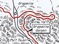
The many stories about Santa Fe's efforts to achieve access to the Pacific Ocean and Southern Pacific's strident efforts to deny Santa Fe that access have been told with so many different interpretations that, depending upon one's bias or loyalties, one may reach conflicting conclusions. However, there seems to be little disagreement about Southern Pacific's stranglehold on the San Joaquin Valley and the efforts of its captive customers to relieve themselves from "The Octopus" which held them captive. The recent (1974) and perhaps most complete analysis of the Santa Fe is "History of the Atchison, Topeka and Santa Fe Railway Company" by Keith L. Bryant Jr. Mr. Bryant, a history professor, was given access to the files and corporate records of the Santa Fe. Beginning on page 173 he describes the frustrations of these captive customers and their decision to form The San Francisco Traffic Association in about 1891. By 1893 The Association had decided that the only way to free San Francisco and the San Joaquin Valley from the monopoly of the Southern Pacific was to build an independent railroad from San Francisco Bay down through the valley to a connection with the Santa Fe. The result was that these shippers, along with investors, formed The San Francisco and San Joaquin Valley Railway on February 26, 1895. Construction south from Stockton commenced later that year, and over 25 miles of track were in place by December. By August 1896 the 123.44 miles to Fresno were completed; by June 1897, 30.20 miles to Hanford were in operation, and by June 1898, the 80.40 miles to Bakersfield had accomplished the creation of a competing railroad through the valley. The investors and shippers who owned the SF&SJV Railway were not, and did not wish to be, railroad operators. Their railroad had no connection with a line, other than SP, which could provide them with access to markets east of California, so they logically sought the Santa Fe as a buyer for their 234-mile railroad. In December 1898, Santa Fe purchased the SF&SJV Railway for $2,462,300, which also included the 43.8-mile branch line from Calwa to Visalia. Santa Fe had leased the SP line from Needles to Mojave in 1894 which, via the A&P, gave them access to the eastern markets, but this still left a 68-mile gap between Mojave and Bakersfield. The above information is generally known or readily available to those interested, but what follows may be new to most readers, as it was to me. It has been generally accepted that Southern Pacific built the Tehachapi Pass line to achieve access to the Los Angeles basin, and/or to utilize it for their route to southern Arizona and Texas. They also built a line with no traffic potential from Mojave to Needles to block Santa Fe. I have recently acquired, by a purchase on eBay, the report by railroad locating engineer Henry D. Minot dated August 5, 1890, which is addressed to A. Manvel, Esq., president of the A.T. & S.F. RR Co., Chicago, Ill. This report, excerpts from which will hereinafter appear, unmistakably show that Santa Fe was looking for another access route to the San Joaquin Valley that would avoid the Tehachapi line already occupied by Southern Pacific. Minot, apparently surreptitiously employed by President Manvel, finds a route that while longer than the line over Tehachapi is lower and has more advantageous ruling grades. He proposes deviating southwesterly from the SP line between Mojave and Waterman (now Barstow) at a location he calls "Rogers," thence proceeding through the Antelope Valley and turns westerly approximately parallel with the present Kern County-Los Angeles County common boundary to a location where a summit tunnel 7,200 feet long would turn the route northwesterly near to Castaic Lake [at Lebec] and thence down into the San Joaquin Valley. While no survey notes or maps accompanied the report, Mr. Minot does state that the proposed line would not go through the Tejon Pass. No description of the route is furnished for that portion of the proposed route after exiting the 7,200-foot tunnel, but it would seem that the logical way into the San Joaquin Valley would have been near to or coincident with the present location of I-5. Minot calls this surveyed line The Fort Tejon Route. Now, quoting from his Report to President Manvel, "The value of The Fort Tejon Route, as presently located, is the economy of the grades. There is an absolute saving of 300 feet as compared with Tehachapi and this saving is worth money in proportion to the volume of traffic. We cannot satisfactorily calculate, on any basis, the cost of lifting a ton of freight 300 feet, but in the aggregate, for a trunk line, the cost is large." Elsewhere he reports: "From Rogers to Bakersfield via Mojave and the Southern Pacific is eighty-eight miles, or thirty miles less than the new route proposed; but the advantage of our line will be so decisive that we can haul the SP's traffic over the mountain at rates less than the cost of operation by Tehachapi and earn a profit. With full compensation for curvature, our line will have a maximum grade westbound of 8/10 percent, or 42 feet to the mile, and eastbound 2 percent, or 105½ feet to the mile. ... Our proposed summit is at an elevation of 3,734 feet, some 300 feet lower than Tehachapi." Through the research of John Sweetser of Bakersfield, California, we learn that The Kern County Californian reported July 19, 1890, that "The party (survey) was camped here (Antelope Valley) for a few days and we learned it is not connected with the Santa Fe System. They will have an entire new route which has already been established with superior advantages. The road ... will run within a mile and a half of the county line to Rogers. Mojave will not be on the route." On July 26, 1890, The Californian reported that "Several gentlemen arrived here (Bakersfield) who are believed to be connected with the Santa Fe. Among them were Henry D. Minot and A. Guthrie of St. Paul." Some idea of the proposed route can be gleaned from the following reports in the Californian, August 2, 1890: "Our little burg (Rosamond), being situated on the S.P.R.R., where the Santa Fe crosses has been very lively of late with the frequent arrivals and departures of the several engineering corps. A new party will make a second technical survey from Rogers to this place and thence to meet another corps coming in from Castaic on a similar mission." September 13, 1890: "Three camps of surveyors are still at work in Tejon Cañon." October 4, 1890: "The engineers on the Tejon ranch making surveys for the new railroad are endeavoring to effect the descent into the valley by means of a loop similar to that of Tehachapi." On December 6, 1890, however, the Kern County Californian stated that "Last Sunday the engineer in charge of the railroad surveys in this county received orders to stop work and pay off his employees. At that time he had three parties in the field, one at the head of Antelope Valley, one in the Canada de Las Uvas (Grapevine Canyon) two miles this side of Fort Tejon and one at Roses [Rose's] Station (near the mouth of Grapevine Canyon)." There is much more to Mr. Minot's report, most of which refers to surveys from Bakersfield to the San Francisco Bay, but until acquiring this report I had never learned of the Fort Tejon Route. Is it reasonable to assume that Southern Pacific knew of this route, which would enable them to have a shorter railroad to the Los Angeles basin and instead built over Tehachapi primarily to block Santa Fe? Or was their motivation to utilize Tehachapi as an easier access to the Mojave Desert and thence on toward Yuma? It is doubtful that the potential of the Los Angeles basin was evident at that time, and certainly the Southern Pacific wanted to build along the 32nd parallel line and establish themselves with a second transcontinental railroad. Then perhaps Tehachapi would provide both a block to the Santa Fe and achieve their other objectives, whatever they may have been. Perhaps others have answered or may answer these interesting questions. However, in the late 1890s, Santa Fe had to connect the Needles-Mojave line, which they had previously acquired from Southern Pacific, with Bakersfield, and they chose a contract with Southern Pacific for trackage rights over Tehachapi. There can be much speculation why Santa Fe made this choice when they seemingly had another option. Certainly the rapid expansion of the Santa Fe system in the 1890s had absorbed large amounts of capital, and the financial panic of 1893 coupled with this expansion caused Santa Fe to reorganize and refinance its debts. Perhaps Southern Pacific created other obstacles for the Fort Tejon Route. Maybe further studies did not confirm the conclusions of Henry Minot. Anyway, the decision was one for President Ripley, not Manvel, and the rest is history. Santa Fe extended the line from Stockton to Ferry Point (Richmond) in 1900 and to Oakland in 1904. As a footnote, in the early 1960s the original contract for trackage rights from Mojave to Kern Junction was to expire and SP sought to extract much higher compensation. Santa Fe once more looked for an alternate route while at the same time asking the Interstate Commerce Commission to participate in establishing an equitable rental. The ICC reduced the SP proposal to a rent Santa Fe felt was fair.
Magazine purchased 2018 by Leon Worden. Download individual pages here.
|
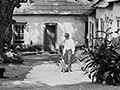
Beale Residence, Photo 1888-1900
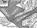
Santa Fe Railroad Plan 1890
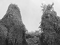
Wild Grape Vines ~1890
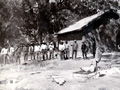
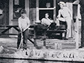
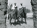
Cowboys 1902
Sale to L.A. Times Syndicate 1912
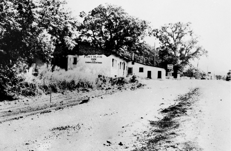
Fort Tejon Inn ~1940
Rose Station 1941
Tejon Trout Lakes 1950s (Mult.)
HQ Ruins 1968
|
The site owner makes no assertions as to ownership of any original copyrights to digitized images. However, these images are intended for Personal or Research use only. Any other kind of use, including but not limited to commercial or scholarly publication in any medium or format, public exhibition, or use online or in a web site, may be subject to additional restrictions including but not limited to the copyrights held by parties other than the site owner. USERS ARE SOLELY RESPONSIBLE for determining the existence of such rights and for obtaining any permissions and/or paying associated fees necessary for the proposed use.
