Looking North & South from Saugus Junction
Saugus, California

Click image to enlarge
| Download archival scan
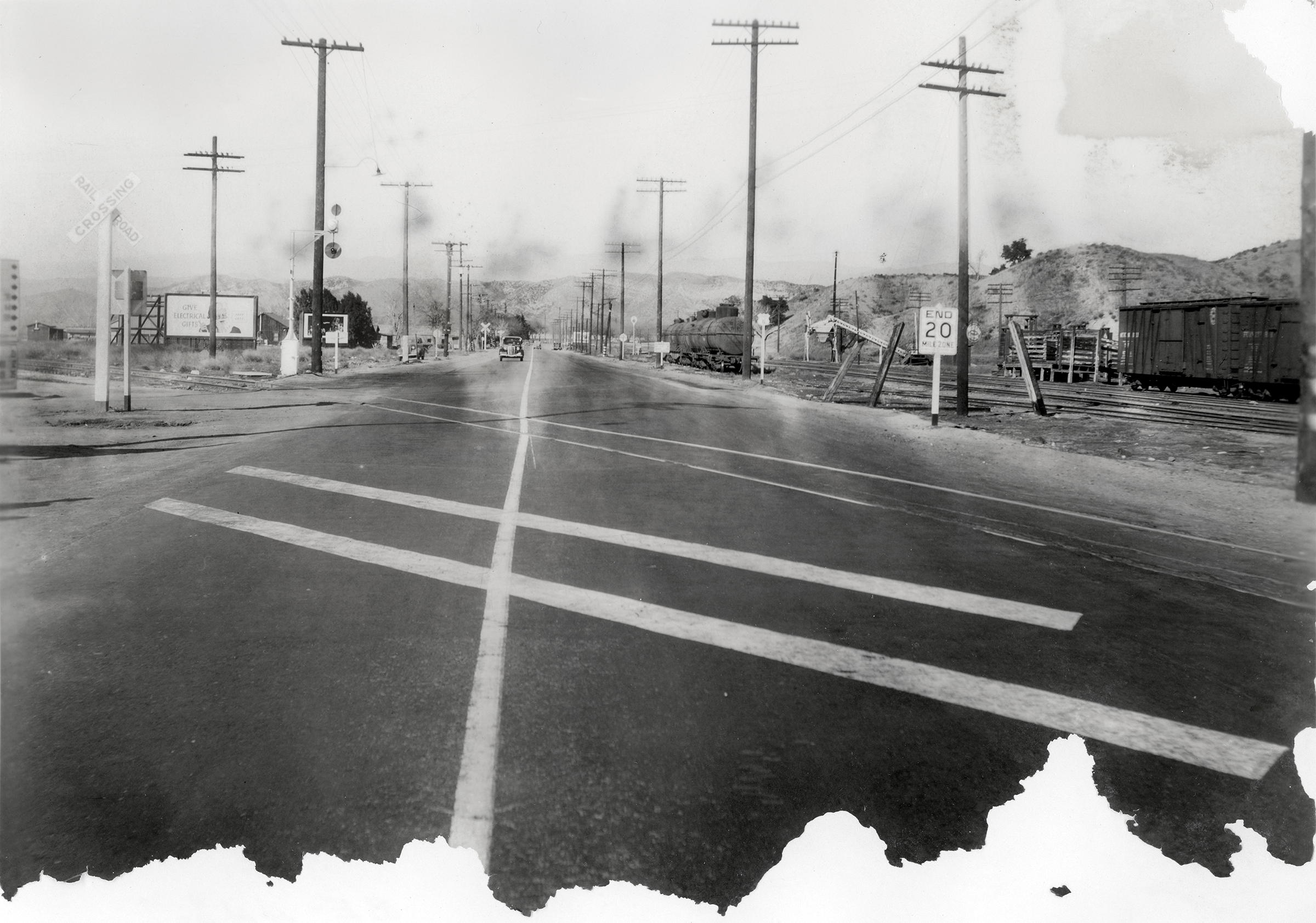
January 4, 1938 — Two views, one looking south (above) and the other north (below) from Saugus Junction. 6¼x8½-inch prints, damaged (probably water damage), especially at the bottom edge. The same forgotten photographer also shot photos of Newhall Junction on the same date. Two months later, the Great Flood of 1938 would make a mess of these scenes. Saugus Junction was the point where the 1887 Southern Pacific spur line (train tracks) left the Saugus Depot and crossed Bouquet Canyon Road, heading west down the Highway 126 corridor to Ventura. Most of those reference points being meaningless to the modern viewer, the Saugus Depot stood at the southeast corner of Bouquet Canyon Road and Drayton Street, where a lumber yard and building supply company later stood (stands). The tracks crossed the road at what is now Magic Mountain Parkway. (The tracks are gone and the Saugus Depot is in Newhall today, but that's another story.) Above: The photographer is standing about 50 yards north of the junction and looking south. The SPRR Saugus Depot is visible at left. It looked like this at the time. The Saugus Café, Fielding Wood's sandwich shop and Wood's Garage are on the right (west) side of the road, center of photograph. Highway 126 (today's Magic Moutain Parkway) is the road that starts in front of Wood's Garage and runs to the right (west). The tracks are there, too, but they're hard to see. The back of the photograph is numbered BE-448.7 #1. Below: The photographer is standing almost on top of the junction and looking north. What you can't quite see at far left is this wayfinding sign — only the edge of it. Note the billboards at left (west) and the "End 20 Mile Zone" (speed limit) sign at right (east). The wooden structure next to the boxcar at right is for loading livestock. The metal structure to the left of it (behind and to the left of the speed-limit sign) is for loading grain. Up ahead in the distance, the shimmering light (more water damage) would lead a motorist to Soledad Canyon Road and Bonelli Stadium (Saugus Speedway). The back of the photograph is numbered BE-448.7 #6.
HS19380104a (top) and HS19380104b (bottom): 9600 dpi jpegs from original photographs in Santa Clarita Valley Historical Society Collection.
|