|
|
Fort Tejon Earthquake
Caltech | Southern California Earthquake Data Center
|
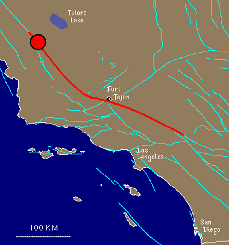
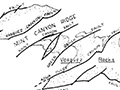
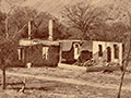
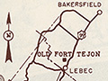
Type of Faulting: right-lateral strike-slip Time: January 9, 1857 / about 8:20 am PST Location: 35° 43' N, 120° 19' W about 72 km (45 miles) northeast of San Luis Obispo, about 120 km (75 miles) northwest of Bakersfield, as shown on the map (epicenter location uncertain). Magnitude: MW 7.9 (approx.) Length of Surface Rupture: about 360 km (225 miles) Maximum Surface Offset: about 9 meters (30 feet) The Fort Tejon earthquake of 1857 was one of the greatest earthquakes ever recorded in the U.S., and left an amazing surface rupture scar over 350 kilometers in length along the San Andreas fault. Yet, despite the immense scale of this quake, only two people were reported killed by the effects of the shock — a woman at Reed's Ranch near Fort Tejon was killed by the collapse of an adobe house, and an elderly man fell dead in a plaza in the Los Angeles area(?). The fact that only two lives were lost was primarily due to the the nature of the quake's setting; California in 1857 was sparsely populated, especially in the regions of strongest shaking, and this fact, along with good fortune, kept the loss of life to a minimum. The effects of the quake were quite dramatic, even frightening. Were the Fort Tejon shock to happen today, the damage would easily run into billions of dollars, and the loss of life would likely be substantial, as the present day communities of Wrightwood, Palmdale, Frazier Park, and Taft (among others) all lie upon or near the 1857 rupture area.
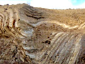
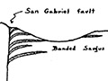
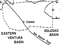
As a result of the shaking, the current of the Kern River was turned upstream, and water ran four feet deep over its banks. The waters of Tulare Lake were thrown upon its shores, stranding fish miles from the original lake bed. The waters of the Mokelumne River were thrown upon its banks, reportedly leaving the bed dry in places. The Los Angeles River was reportedly flung out of its bed, too. Cracks appeared in the ground near San Bernadino and in the San Gabriel Valley. Some of the artesian wells in Santa Clara Valley ceased to flow, and others increased in output. New springs were formed near Santa Barbara and San Fernando. Ridges (moletracks) several meters wide and over a meter high were formed in several places. In Ventura, the mission sustained considerable damage, and part of the church tower collapsed. At Fort Tejon, where shaking was greatest, damage was severe. All around southern and central California, the strong shaking caused by the 1857 shock was reported to have lasted for at least one minute, possibly two or three! The surface rupture caused by the quake was extensive. The San Andreas fault broke the surface continuously for at least 350 km (220 miles), possibly as much as 400 km (250 miles), with an average slip of 4.5 meters (15 feet), and a maximum displacement of about 9 meters (30 feet) (possibly greater) in the Carrizo Plain area. Kerry Sieh (1978) noted that the Elkhorn Thrust, a low-angle thrust fault near the San Andreas, may have slipped simultaneously in the 1857 quake — an observation that a team of researchers (1996) have recently used to support the idea that future movements along the San Andreas fault zone might produce simultaneous rupture on thrust faults in and near the Los Angeles area, causing a terrible "double earthquake." The location of the epicenter of the Fort Tejon earthquake is not known. As the name suggests, one idea is to locate it near the area of strongest reported shaking — Fort Tejon. However, because there is evidence that foreshocks to the 1857 earthquake may have occurred in the Parkfield area, it is located on this map near the northwestern end of the surface rupture, just southeast of Parkfield, near Cholame. (Note: locating it near Fort Tejon would also have caused interference on the map between this quake's symbol and that of the 1952 Kern County quake. Hence, for both these reasons, the Cholame location was chosen.)
|
Video: Field Guide to the San Andreas Fault
1857 Fort Tejon Quake
Fault in Palmdale
Geology of Canyon Country (Dort 1948)
Strike-Slip Displacement (Crowell 1954)
Winterer & Durham 1962
Castaic Geology (Stitt 1981)
Soledad Basin (Muehlberger 1954)
Inventory of State Park Collection
Self-Guided Tour 1996
Huell Howser Program 1999
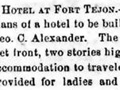
Hotel Plan 1858
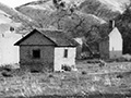
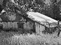
Ruins (Mult.)
Rancho La Liebre 1929 (Story)
Postcard 1930s
Flying A Gasoline 1938
Home Movie 1939
Book: Old Adobes (Cullimore 1949)
Travelogue 1949
Old Gate Pre-1950
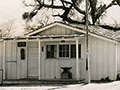
Officers' Quarters ~1950s
Headquarters Bldg. 1957 (Story)
Brochure Pre-1967
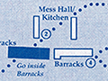
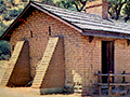
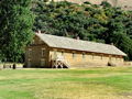
Enlisted Men's Barracks (Mult.)
• 1857 Earthquake (1)
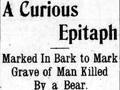
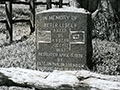
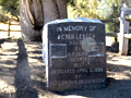
Peter Lebeck Exhumed 1890
Lebeck Story 1901
Lebeck Grave 1957 (Story)
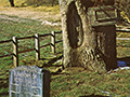
Lebeck Oak ~1960s
Lebeck Oak & Grave Marker x7
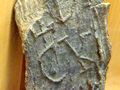
Lebeck Bark x2
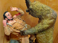
Lebeck Sculpture x3
|

The site owner makes no assertions as to ownership of any original copyrights to digitized images. However, these images are intended for Personal or Research use only. Any other kind of use, including but not limited to commercial or scholarly publication in any medium or format, public exhibition, or use online or in a web site, may be subject to additional restrictions including but not limited to the copyrights held by parties other than the site owner. USERS ARE SOLELY RESPONSIBLE for determining the existence of such rights and for obtaining any permissions and/or paying associated fees necessary for the proposed use.
