|
|

Guide to the Fort Tejon State Historic Park Collection 1845-2009.
McClellan, California | Completed December 2015.
|
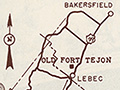
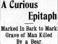
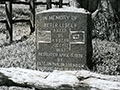
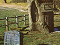
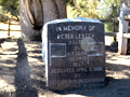
Abstract. Fort Tejon State Historic Park is located in the San Emigdio Mountains near the top of the Grapevine Canyon, on the west side of Hwy 5 near the city of Lebec, California. The park was established in 1940 and contains 647 acres of oakwooded hillsides, grassland, wetlands, riparian vegetation, restored and reconstructed buildings, and the ruins of Fort Tejon. The Fort Tejon State Historic Park Collection is arranged in sixteen series: 1. Correspondence, 2. Histories, 3. Ranger Logs, 4. Interpretation, 5. Subject Files, 6. Legal Documents, 7. Financial Documents, 8. Facilities Documents, 9. Maintenance Records, 10. Publications, 11. Ephemera, 12. Cartographic Material, 13. Photographic Material, 14. Media, and 15. Reports. Items span the years 1845-2009 with the bulk of the material falling between 1980-1991. Administrative History. Fort Tejon State Historic Park is located in the San Emigdio Mountains near the top of the Grapevine Canyon, near the city of Lebec, California. Established in 1940, the park contains 647 acres of oak-wooded hillsides, grassland, wetlands, riparian vegetation and the ruins of Fort Tejon. The U.S. Army established Fort Tejon in 1854 to replace Fort Miller, control the Indians living on the Sebastian Indian Reservation, and to protect both the Indians and white settlers from raids by regional Indian groups. From 1854-1864 various regiments manned the Fort, including the 1st U.S. Dragoons. On September 11, 1864 the Federal government abandoned the Fort; the property became privately owned ranchland. During the Fort's ten years of operation the Dragoons campaigned against the Indians, maintained civil order, and transported goods and people throughout the area. An interesting feature of the Fort was the U.S. Camel Corps. In the 1850s the U.S. Army experimented with the use of camels for transport across the arid south west. The project was quickly scrapped after the first official test in 1860 between Los Angeles and Fort Mojave. Prior to the Army's purchase, the camels were used to haul supplies for Edward F. Beale, former California Superintendent of Indian Affairs and Samuel Bishop, Tejon Ranch owner. The site of the fort is also well known for the grave marker of Peter LeBec, an early frontiersmen and fur trapper, mauled by a bear. Little further evidence of LaBec has surfaced but many fantastical stories have circulated creating a mysterious and exciting past for the man buried under LeBec Tree. In 1936 Fort Tejon was listed as California Historic Landmark #129 (not dedicated until 1954). In 1940 Tejon Ranch donated seven acres of land to the state for the establishment of the park. Between 1940 and 1955 Tejon Ranch donated an additional 199 acres. The Department of Parks and Recreation owns the majority of the area associated with the garrison portion of the Fort Tejon complex. Portions of the site — including the quartermaster facilities and storehouses — are not state owned property. In June 1962 the park was officially classified and renamed Fort Tejon State Historic Park. Since then small portions of the original fort complex have been reconstructed or preserved. The buildings at the park feature a number of interpretive displays where re-enactors teach park guests about the daily lives of the soldiers stationed at the fort. Other museum exhibits cover topics of army life and local history. The park features a campground, picnic area, hiking trails, and civil war re-enactments. The fort was listed on the National Register of Historic Places in 1971. In the mid-2000s a second donation of property from a private landowner added an additional 442 acres to the park.
Download original pdf here.
|
Inventory of State Park Collection
Self-Guided Tour 1996
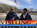
Huell Howser Program 1999
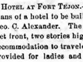
Hotel Plan 1858
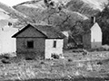
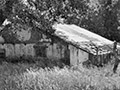
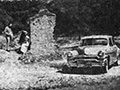
Ruins (Mult.)
Rancho La Liebre 1929 (Story)
Postcard 1930s
Flying A Gasoline 1938
Home Movie 1939
Book: Old Adobes (Cullimore 1949)
Travelogue 1949
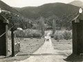
Old Gate Pre-1950
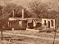
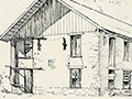
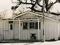
Officers' Quarters ~1950s
Headquarters Bldg. 1957 (Story)
Brochure Pre-1967
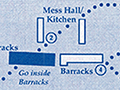
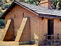
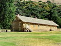
Enlisted Men's Barracks (Mult.)
• 1857 Earthquake (1)
Peter Lebeck Exhumed 1890
Lebeck Story 1901
Lebeck Grave 1957 (Story)
Lebeck Oak ~1960s
Lebeck Oak & Grave Marker x7
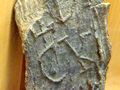
Lebeck Bark x2
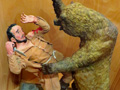
Lebeck Sculpture x3
|
The site owner makes no assertions as to ownership of any original copyrights to digitized images. However, these images are intended for Personal or Research use only. Any other kind of use, including but not limited to commercial or scholarly publication in any medium or format, public exhibition, or use online or in a web site, may be subject to additional restrictions including but not limited to the copyrights held by parties other than the site owner. USERS ARE SOLELY RESPONSIBLE for determining the existence of such rights and for obtaining any permissions and/or paying associated fees necessary for the proposed use.
